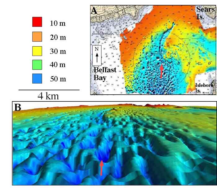
1. Multibeam bathymetric maps of Belfast Bay. Colors are coded to depth of water in meters. A) Map view of Pockmark Field. B) Oblique view of pockmark field. Arrow points to approximately the same location in each illustration.
1. Multibeam bathymetric maps of Belfast Bay. Colors are coded to depth of water in meters. A) Map view of Pockmark Field. B) Oblique view of pockmark field. Arrow points to approximately the same location in each illustration.