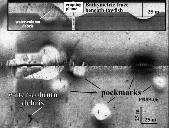
Side scan sonar image of erupting pockmark. Dark horizontal line down center of image represents path of towed devise. Area of view is approximately 200 meters by 300 meters. Circular features are crater-like pockmarks. They appear as white circles when they are too deep for the sound to reach the bottom and black where the device passes over the pockmark. Inset illustration is a fathometer trace beneath the center track line showing the erupting plume.