Immense change in the extent and volume of the West Antarctic Ice Sheet
has occurred over the past 20,000 years and may be ongoing.
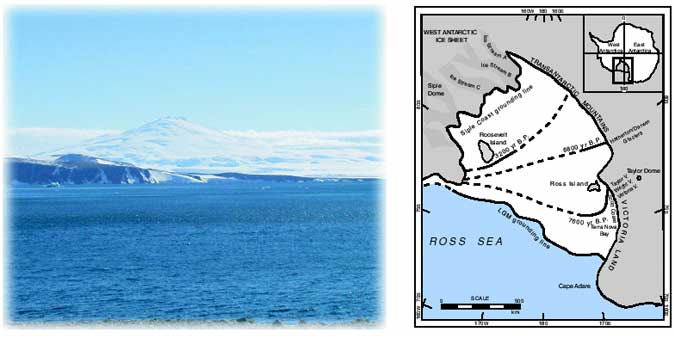
The West Antarctic Ice Sheet (WAIS) is believed to be inherently unstable, because it rests on bedrock that is well below sea level. If the ice sheet were to collapse, global sea level would rise six meters, inundating ocean islands, port cities, and highly populated coastal areas. Such collapses may have happened during previous interglacial periods. One way in which to gain insight into the future of the ice sheet is to examine its past. Our glacial geologic evidence indicates that the ice sheet was much more extensive during the last ice age, extending to the continental shelf edge in the Ross Sea Embayment. Our current research is devoted to determining the timing of ice-sheet retreat to its present position. If we can reconstruct the history of ice recession, we can begin to isolate the mechanisms (such as rising sea level or climate warming) that affect the stability of the WAIS.
Main Conclusions:
(1) Deglaciation of the Ross Sea is a late event, compared to ice recession elsewhere in the world.
(2) Most of the Ross Sea Embayment was still filled with ice in the mid-Holocene, after sea-level rise from melting of Northern Hemisphere ice sheets (long thought to be responsible for WAIS retreat) was accomplished. Thus, rising sea level could not have driven ice recession.
(3) Reconstruction of ice retreat shows that recession continued until very recently and, in fact, still may be ongoing. We think this may be due to processes internal to the ice sheet that were set in motion thousands of years ago - not the result of any present climate or sea-level forcing. If true, then retreat could continue back into the heart of the ice sheet, causing collapse.
A history of WAIS retreat in the Ross Sea Embayment comes from, among other things, relative sea-level data. Raised beaches, formed when the earth's crust rises after the ice load is removed, afford a means of determining the age of deglaciation. Radiocarbon dates of organic material within the beaches allow us to produce relative sea-level curves and hence to determine the timing of deglaciation.
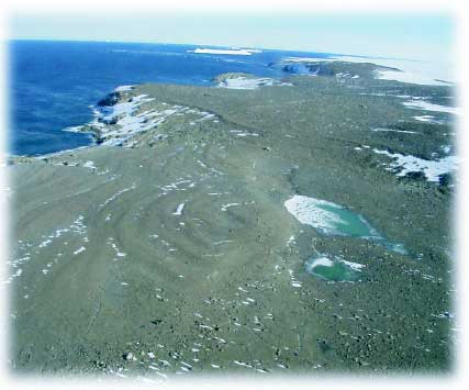
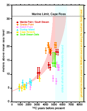
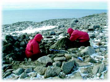
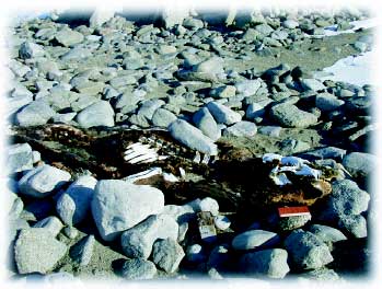
Raised beaches are notoriously hard to date because of the scarcity of organic material in the Antarctic. However, we discovered and pioneered the use of elephant seal skin in the Ross Sea region raised beaches. The skin, along with shells and penguin remains and guano, has allowed us to construct detailed curves for the southern Scott Coast and Terra Nova Bay, which in turn have afforded us information regarding the timing of deglaciation.
Selected References:
Conway, H., Hall, B.L., Denton, G.H., Gades, A.M., and Waddington, E.D., 1999. Past and future grounding-line retreat of the West Antarctic Ice Sheet, Science, 286, 280-283.
Denton, G.H., and Hall, B.L. (eds.), 2000. Glacial and paleoclimate history of the Ross ice drainage system of Antarctica, Geografiska Annaler, 82A (2-3), 139-432.
Hall, B.L., and Denton, G.H., 2000. Radiocarbon chronology of Ross Sea drift, eastern Taylor Valley, Antarctica, Evidence for a grounded ice sheet in the Ross Sea at the last glacial maximum, Geografiska Annaler, 82A, 305-336.
Hall, B.L., and Denton, G.H., 1999. New relative sea-level curves from the southern Scott Coast, Antarctica: Evidence for Holocene deglaciation of the western Ross Sea, Journal of Quaternary Science, 14, 641-650.