Archaeology at the Bull Brook Site

The first humans arrived in northeastern North America about 11,000 radiocarbon years ago, when glacial ice still covered much of Canada north of the Gulf of Saint Lawrence. Makers of the distinctive fluted projectile points spread across North America, coping with changing environments and relatively low population densities. Site locations bear little relationship to those of the Archaic period that commenced about 1000 to 2000 years later. Caribou may have been a driving force behind Paleoindian settlement systems in the Northeast, but this is a debatable and caribou movements are difficult to predict in modern times, let alone the Pleistocene.
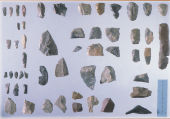
Despite these uncertainties, Paleoindians left clues that may provide unusually clear evidence of their movements and periodic gatherings. For example, they often used high quality stone for their tools, transporting it great distances, tracking the direction and distance of their travels. Although population densities are thought to have been low, there are a few large sites that may reveal the largest scale of group organization.
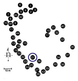
The Bull Brook site in Ipswich, Massachusetts is one of the largest Paleoindian sites in North America. Over 40 concentrations of artifacts (thought to be individual hut locations) are arranged in a large circle nearly 500 feet across. Does the site represent a large gathering of bands that were normally dispersed over the Northeast landscape, or a few bands that returned to the same location for many years? The institute is undertaking an analysis of this and other problems related to the Bull Brook site, in cooperation with the Peabody Essex Museum of Salem, Mass.
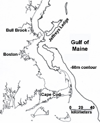
While major effort will be invested in defining variability within Bull Brook, understanding the site requires a broad array of environmental and cultural investigations. Much of the stone used to manufacture tools may have come from northern Maine, but this source is in competition with others from Vermont and New York, among more distant locations. Sea level was 50 to 60 meters lower at 11,000 B.P. exposing a large cape east of the Bull Brook site, where a major fishing bank now exists. Was this ancient cape a significant attraction to grazing animals and people on Pleistocene Gulf of Maine?
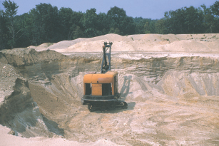
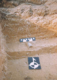
Bull Brook was excavated between 40 and 50 years ago by a dedicated group of avocational archaeologists in cooperation with a Harvard graduate student and archaeologists at the Robert S. Peabody Museum. The site was salvaged in front of steam shovels that destroyed it by 1960. Although widely known, the evidence has not been published in sufficient detail to test some of the implications of the ring-shaped settlement plan. Mapping and artifact distributions will be intensively analyzed with the invaluable assistance of some of the original excavators.
Selected References
Byers, D. A., 1954, Bull-Brook- A Fluted Point Site in Ipswich, Massachusetts, American Antiquity 19(4):343-351
Eldridge, W. E. and J. Vaccaro, 1952, The Bull Brook Site, Ipswich, Mass. Bulletin of the Massachusetts Archaeology Society 13(4):39-43.
Grimes, J. R., 1979, A New Look at Bull Brook. Anthropology 3:109-130.
Jordan, D. F., 1960, The Bull Brook Site in Relation to “Fluted Point” Manifestations in Eastern North America. Ph.D. dissertation, Harvard University, Cambridge.