Hyper-arid desert coast once supported significant farming during prehistoric and historic times
Hyper-arid desert coast once supported significant farming during prehistoric and historic times
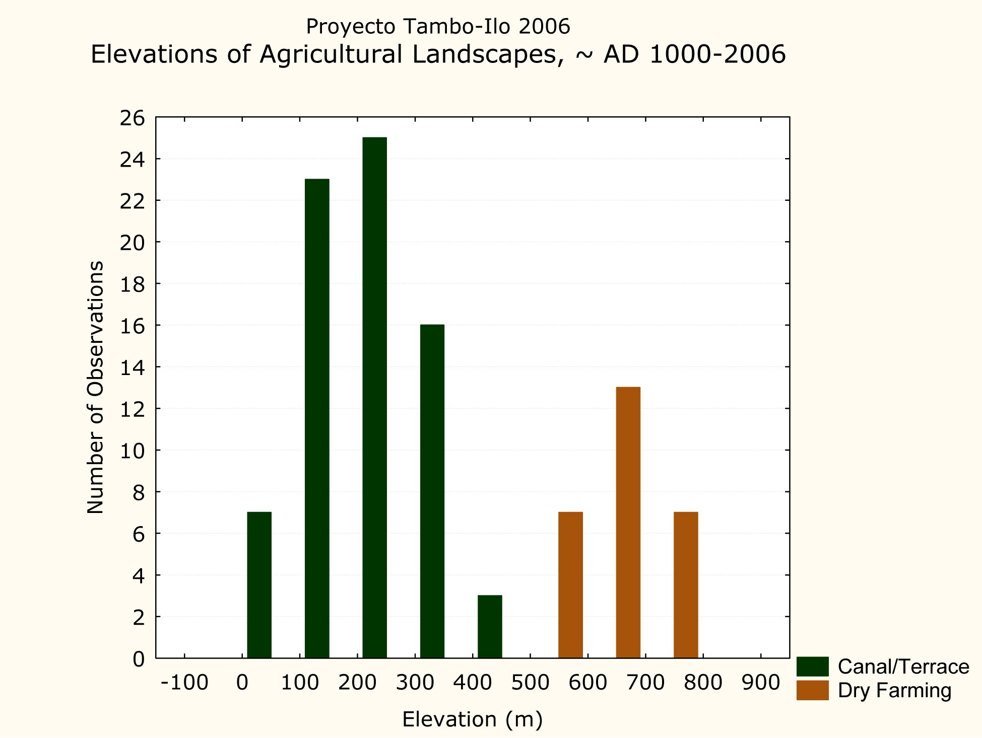
Today the Peruvian south coast between the Tambo and Ilo rivers is a dry and desolate landscape. The vegetation scattered among the inland hills has diminished considerably, while agriculture in the area has been reduced to only a few surviving farmsteads. Yet, recent archaeological research indicates that farming was once a significant and viable activity along this intervalley coastline, and that the inland hills provided some opportunities for both dry farming and herding (Figure below).
However, the degree to which this largely desiccated and depopulated landscape is a product of recent history or has roots in the more ancient past remains uncertain. It is also unclear what role human groups have played in environmental change over the past millennium.
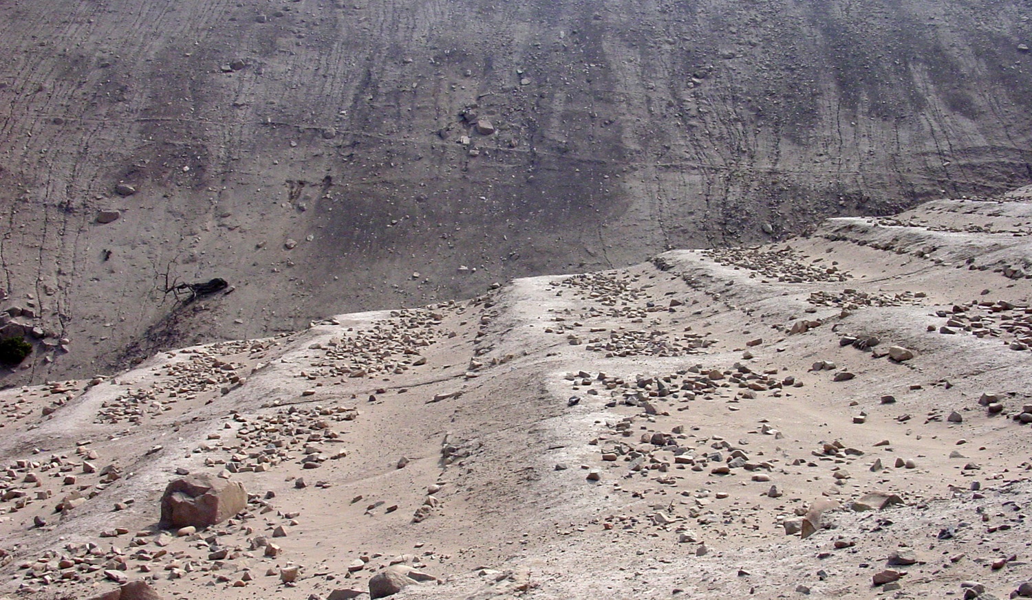
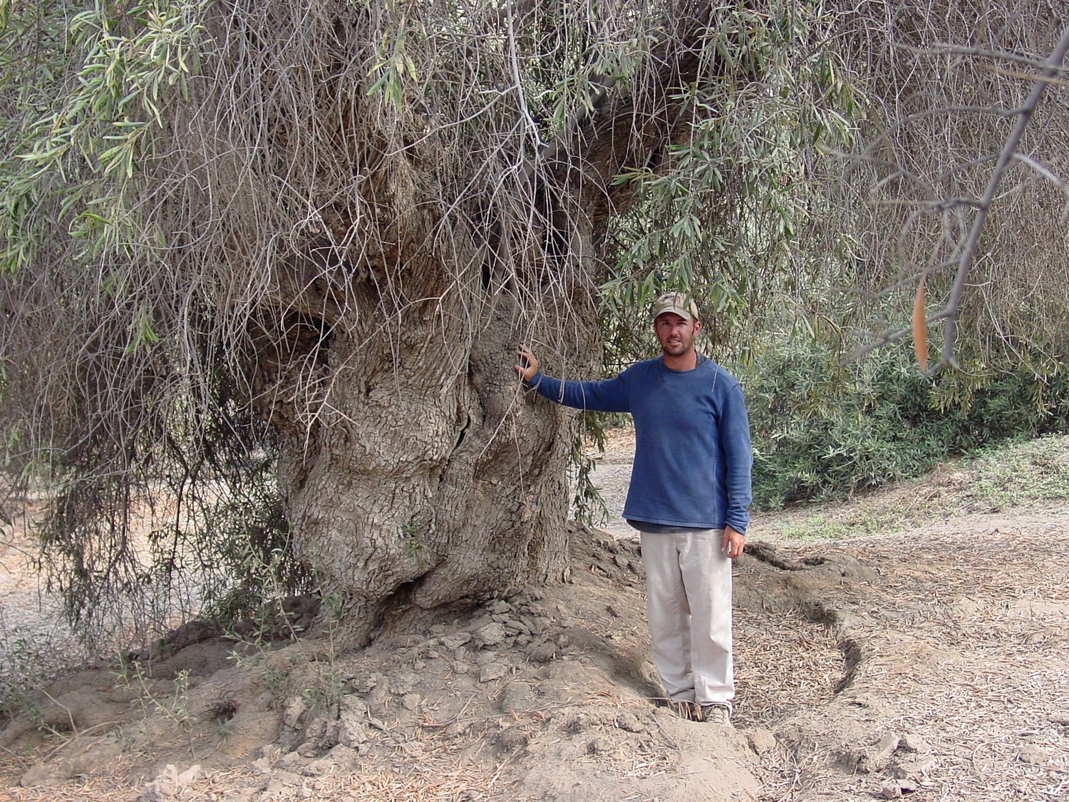
Agricultural landscapes are particularly important manifestations of human-environment dynamics in arid ecosystems because they represent conscious efforts to manipulate the physical world (Figs. 2 & 3). As such, they can be used to track changes in the relationship between people and the environment over long periods of time.
However, as people modify the landscape, irreversible changes can occur that diminish opportunities for some farming strategies, while at the same time creating possibilities for other approaches initially deemed infeasible.
Human manipulation of the environment produces new historically contingent elements that did not previously exist, and consequently, human agency must be considered along with other non-human biological and geophysical processes as sources of environmental change (Foster, et al. 2003; Sandor & Eash, 1991).
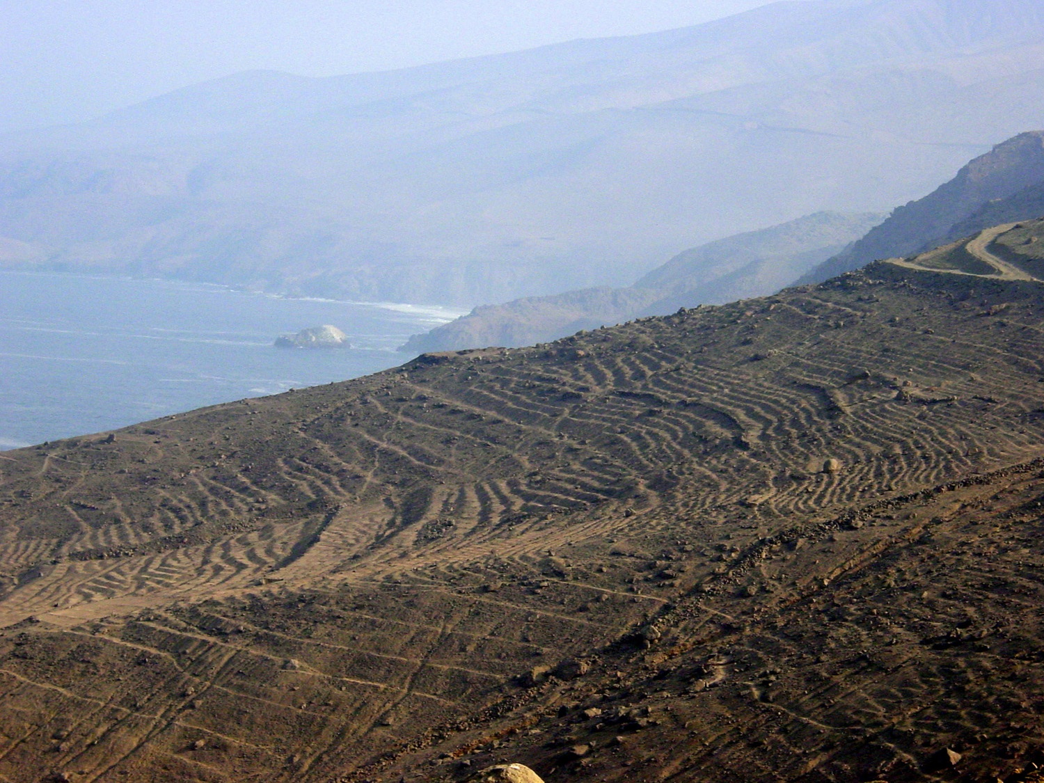
Previous research at Wawakiki spring, an abandoned agricultural complex situated some 22 km north along the coast from the port of Ilo, Peru, suggests that human activities there played a significant role in shaping the local environment (Zaro, 2005, 2007; Zaro & Umire Alvarez, 2005). As an anthropogenic landscape, it is historically rooted in over seven centuries of land use, including intensive canal and terrace agriculture during the late Chiribaya (A.D. 1200-1400) and early Spanish colonial (A.D. 1600-1750) periods (Fig. 4). Soil erosion likely began during the 15th and 16th centuries, but became more pronounced by the 18th century.
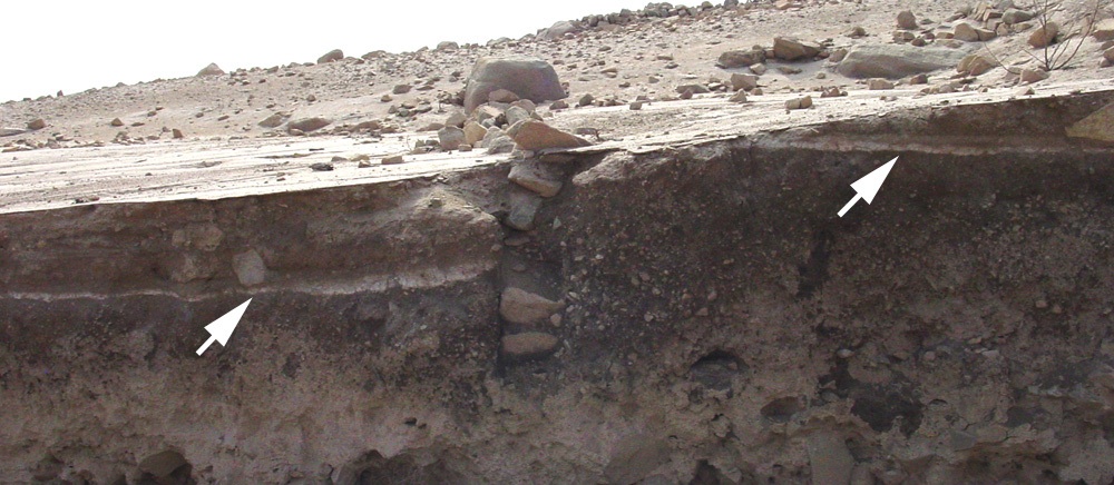
Our current research is centered on an abandoned agricultural complex about 20 km north of Wawakiki. This site exhibits well-preserved remains of agriculture and other human activities scattered 2 km along a dry wash. The area appears to have been farmed, if only intermittently, from at least the pre-Hispanic Chiribaya period (~AD 900-1400) into the 20th century (Fig 5), but the process of environmental change remains unclear. Our research draws from anthropology, geology, soil chemistry, paleoethnobotany, and zooarchaeology to assess long-term environmental change in the area, and specifically the role human groups have played that change over the past millennium.
Selected References
Foster, D., F. Swanson, J. Aber, I. Burke, N. Brokaw, D. Tilman and A. Knapp (2003). The importance of land-use legacies to ecology and conservation. Bioscience 53(1):77-88.
Sandor, J. A. and N. S. Eash (1991). Significance of Ancient Agricultural Soils for Long-Term Agronomic Studies and Sustainable Agriculture Research. Agronomy Journal 83(1):29-37.
Zaro, G. (2007). Diversity specialists: coastal resource management and historical contingency in the Osmore desert of southern Peru. Latin American Antiquity 18(2), in press.
Zaro, G. (2005). Human Ecology and Ancient Agrarian Land Use at Wawakiki Spring, South Coast Peru, A.D. 1000-2000. Ph.D. dissertation, Department of Anthropology, University of New Mexico, Albuquerque.
Zaro, G. and A. Umire Alvarez (2005). Late Chiribaya agriculture and risk management along the arid Andean coast of southern Peru, A.D. 1200-1400. Geoarchaeology, an International Journal 20(7):717-737.