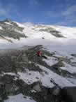
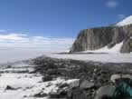
Our crew explored the other edge of Darling Ridge today, to the east of camp. I awoke at 0640h and rendered the water hot and the coffee strong for the emerging scientists. After breakfast and organizing gear, we rode the ski-doos about 7 km out to Treves Butte, which with the sastrugi took about an hour. Nearing the bluffs, we entered a blue-ice zone revealing a beautiful garden of erratics. Drawing closer, an ice-cored moraine appeared beyond the increasing concentration of rock emerging from the sublimating ice. After a bumpy ride, we arrived at the system of ice-cored moraines previously described by Mercer in the 1960’s.
The mélange of lithologies comprising the moraines was astounding – quite the opposite of what I expected. Erratics eroded out of the Permian tillite were of a myriad of different Gondwanaland origins, with perfectly preserved striated cobbles. If one was unaware of the existence of the tillite, the moraines would have been utterly confusing… With a mixture of wet-based Permian cobbles and cold-based supraglacial debris, there is no telling what conclusions may have been drawn!
During the day we sampled a transect across the profile of the largeice-cored moraine. The moraine appeared to be a medial moraine formed by the confluence of a nearby alpine glacier flowing north from the Discovery Ridge cliffs, and a small stream from the ice sheet flowing through a gorge in the bedrock. The gorge is curious, since there is an obvious offset in the bedrock stratigraphy between Discovery Ridge and Treves Butte, suggesting it might be a thrust fault hoisting the Treves Butte granites several hundred meters higher than the contact. Preferential erosion of the fault is what may have produced the gorge allowing ice to flow through. However, through subsequent lowering of the ice sheet, it appears as though this little trickle has since shut off, resulting in the stagnation of where we found the ice-cored moraines. All that remains are some impressive crevasses being inundated by large wind-scoops.
The concentration of debris through the sublimation of the ice seems to have preserved ice underlying the areas of the thickest debris accumulations. The resultant structure is a preserved ice-cored ‘crest,’ which we take to suggest the minimum thickness of the ice sheet when the first bits of debris began to emerge.
Guided under these premises, we decided to take samples on the crest, and towards the base of the moraine. The crest samples might suggest the age at which the ice-sheet stood at that elevation, and the lower samples would reveal the inherited component of the cosmogenic nuclides. Since they are just emerging, they should have an exposure age of zero – thus allowing us to calibrate the crest samples by subtracting the ages given by the lower samples.
A typical sample was collected by selecting an erratic based on the following criteria: First, the mineralogy must be such that there will have been production of cosmogenic nuclides. In this case, the quartz from the granite is useful for detection of 10Be and 26Al (from spallation reactions with silicon and oxygen, respectively). Also, mafic minerals, such as clinopyroxene and olivine from basalt, yield 3He, which is useful for determine exposure ages. In the case of the Discovery Ridge moraine, we sampled primarily granites, since there were very few mafic rocks to be found. Basaltic cobbles from the tillite were sampled, though sparingly – due to the possibility for prior exposure after deposition in the late Permian.
The second consideration for selecting an erratic to sample was
to find rocks that appeared not to have prior exposure. Supraglacial
rock-fall derived debris often times includes portions of exposed cliff faces,
which under cold-base glaciation may have been exposed for long periods of time before
eventually falling onto the ice. Therefore rocks with heavily weathered (rounded,
cavernously weathered, exfoliating) faces were avoided, and the most angular fresh-looking
subjects preferred.
The third consideration was to select erratics that have not
been translated or rotated since deposition by the ice. For this purpose,
large rocks that would not easily slide were generally preferred, and rocks
located in frost-patterned karsts were avoided. Perched boulders were preferred, since it
is unlikely that any other process could have placed them in such precarious
positions.
Other considerations were certainly made regarding rock shape, and just the ease of actually knocking a sample off of them. Rocks with flat tops were preferred, due to their maximum exposure to the skyfield. Samples were always taken from the tops of boulders, to minimize the effect of shielded parts of the large rocks.
Then, since we were working in an area surrounded by large escarpments, we had to account for the amount of shielding from cosmic rays by the mountains. Shielding corrections were made using a Brunton compass and a Suunto clinometer, where the inclination of the various peaks was measured with the associated bearing.
Once the sample was selected, and the shielding correction made, the elevation and position of the erratic were recorded. The length, width, and heighth of the boulder was quantified, and the sample was photographed with a scale once up close, and once within its surroundings. After the measurements, we proceeded to collected a substantial sample for later analysis by bashing it with a rock hammer! The sample was then bagged and tagged, and it was off to the next. We generally sampled at least three rocks per location, trying to select multiple lithologies if possible for age comparisons and calibrations.
In addition to sampling the rocks, I had the divine privilege of operating the Trimble differential GPS unit. This is quite the instrument, as it provides millimeter scale precision for location, and centimeter scale precision for elevation. The unit consists of a base station which we set up at camp, and constantly logs data with a stationary antenna. In the field we use a roving setup which initializes with the base station, and remotely collects data points and continuous transects. For the Discovery Ridge moraine, I collected a topographic profile both on the longitudinal and transverse axes. I then collected data points for each sample site. This data will be useful in reconstructing the profile of the moraine, and then relating the ages of the various samples with the associated moraine elevations… These ice-cored moraines are tricky, so we definitely need to use every possible method to figure them out!
So ends the sampling diatribe. Sampling, beyond the technical scheme of things, can be an adventure. Today, a stiff,
cold wind blasted through the gorge, and rendered my hands useless without thick gloves.
So I operated in spurts of writing and measuring shielding until I could no longer
move my fingers, warming them up again, and repeating the process. Needless to say,
what would normally take a few minutes took a bit longer for all of us today – but
the body adapts, and learning ways of blocking the wind definitely made the situation
more physically bearable.
We sampled until about 1800h, and raced back to camp for dinner. Pete made a delicious spaghetti with sausage
sauce, which was quickly devoured. The bedtime exodus shortly ensued, and hopes for more exciting
adventures in science tomorrow propagate through my mind as I drift off to sleep. Bless bless.


