Another day in the Ohio Range, yet chock full of new ideas and experiences. The weather was rather calm, temperature about 0 degrees C, and the warm wind in the morning around 11 kts from the east. The visibility was still poor, with the ridges obscured in cloud, so we were again bound for Discovery Ridge. Instead of sampling ice-cored moraines, however, we climbed up to the granite/sandstone terrace in the Discovery gorge.
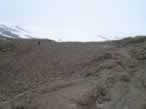
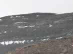
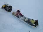
To access the terraced bench, we took the ski-doos as high as possible on the snowslope adjacent to the cliffs. With crampons on foot and axe in hand, we ascended the snowslope which brought us to the granite terrace. The bedrock granite looked significantly more weathered than the angular erratics seen in the moraines, and appeared to have been subject to wet-based glacial abrasion! The surface was very similar to what one might see on the stoss side of a roche moutonee in coastal Maine! Moreover, the ramp seemed to be on the lee side of the current ice flow, suggesting that the ice responsible for scraping and smoothing that granite was flowing the opposite direction, from west to east. A smattering of granite erratics lay perched on the bedrock surface, and the freshest looking rocks were sampled. It is my hunch that these erratics represented the oldest and most extensive ice-sheet elevation (perhaps from the Penultimate glaciation?)… Hopefully the samples will reveal this…
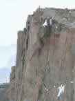
The view from the Discovery Ridge bench was spectacular! The vertical
granite cliffs soar hundreds of meters into the air, and alpine
glaciers flow into
the ice sheet, with blue-ice zones revealing looping debris bands. Additionally,
the ridge has a fascinating sequence of Permian sedimentary units comprising
the Tillite sequence. Following the outcrop up the ridge, I noticed the
glacially abraded granites topped by a cross-bedded sandstone
unit. I believe the granite
and the sandstone may be pre-Permian, as the sandstone was terraced and
appeared abraded as well, followed by a sharp unconformity between
it and overlying
diamictite. The lithified diamict was likely a tillite because it was full
of striated cobbles. The thin layer was then topped by a coarse-grained
sandstone with pinched bedding suggesting lithified braided outwash
(or deltaic sediments?).
The sandstone then graded into a massive, shale outcrop with many inclusions
of small pebbles and large cobbles. This, to me, appeared to be a massive
marine mud full of dropstones. Sujoy agreed that it was a lithified aqueous
deposit,
but questioned whether or not it was marine or lacustrine (based on the
assumption that Gondwanaland glaciations were primarily interior
continental glaciers
that didn’t necessarily see the ocean). Robert disagreed altogether,
suggesting it was a lodgement till, based on the massive matrix.
Following the outcrop a little further up, another thin layer of braided
outwash sands could be seen, followed again by the controversial massive
diamict. In
order to resolve this controversy, I followed the unit a far as I could
before the others looked restless for dinner, and discovered that the unit
graded
into rhythmic laminae with layers deformed from the dropstones. So, I remain
steadfast behind my hypothesis that it was an ice-proximal marine environment
grading to distal (with the interruption of braded sands possibly indicating
a small advance?). Margaret Bradshaw’s work also mentions permo-carboniferous
fossiliferous marine sedimentary rocks topped by terrestrial shales and
coal (which we will see at Mercer Ridge, I expect), indicating a very similar
glacio-marine stratigraphy to sub-marine limit Maine (which, of course
is only 12,000 years old, not lithified, with terrestrial living organics
instead of coal)! I think the Permian ice denuded the granite and sandstone,
deposited a thin layer of basal till, deposited coarse sands (possibly
due to high discharge), and then as the ice edge retreated, a proximal
high discharge deposited the massive marine muds. Calving icebergs contributed
dropstones, and then an advance deposited another layer of the coarse sandy
material from an increased discharge flow regime. With further retreat
of the ice, sedimentation began to represent an increasingly more distal
environment, with preservation of rhythmic laminae and marine fossils.
With isostatic uplift, the shallow marine environment then became terrestrial,
home to the Glossopteris flora.
Just a little story woven from a glimpse at the Discovery Ridge rocks.
Perhaps this region was once the coast of Gondwanaland, maybe not too dissimilar
from coastal Maine! It will be interesting to do a more thorough examination
of
the bedrock literature of Margaret Bradshaw, and see where my hypothesis
stands.
After scrambling around on the ridge until 1900h, we became sucked
into a snowy sphere of visibility (or rather, lack thereof).
We slowly found
our
way back
to camp, rattled by the jolts of sastrugi rendered invisible by the null
depth perception in the ambient light. I must say, however, the pure
white snow drifting
across the glowing blue ice was quite spectacular.
So after a quick dinner, it is off to the sack. With hot water bottles
keeping my feet warm, and a reorientation of my sleeping arrangement
keeping my head
above my feet in the constantly changing sub-tent snow/ice topography,
I have to think that this is the epitome of life and comfort. Who would
have
thought
such things could be so readily obtained in an environment known for
its absolute harshness? I surely am not one to complain.


