
Implications for the Global Extent and Character of the Little Ice Age
and Charles Porter
Patagonia Research Foundation, and UMaine
March 1, 2006 to May 1, 2006
The Little Ice Age (LIA) is classically defined in the Swiss Alps as an interval of glacial expansion dating from about A.D. 1300 to A.D. 1854-1865 (Holzhauser et al., 2005). In Europe, this period is characterized by two prolonged episodes of glacial expansion separated by an interval of retreat in the early 1500s and followed by rapid recession beginning in 1850-1865. Two exceptions to this recent meltdown include short-lived periods of advance during the 1920s and 1970s/1980s. Both the overall cause of the LIA, as well as the reason for the anomalous 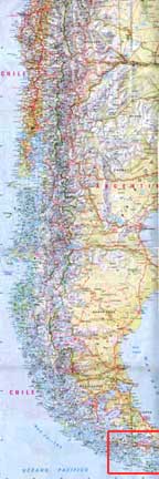 20th century advances, remain unknown.
In order to determine late Holocene ice extent in the Cordillera Darwin, we will map and date moraines at more than 10 key glaciers on both the south (wet) and north (dry) sides of the range (Figure below). These glaciers have been chosen because of previous reconnaissance, as well as photographs that document ice positions throughout the 20th century. We will map former ice extent first from air photographs and then in the field. Using these maps, as well as historical photographs, we will identify key moraines for dating. Dating will be accomplished in three ways. First, organic remains exposed in section within the moraines and trees killed by advancing ice will be sampled in order to bracket closely the timing of advance. Second, the ages of the oldest trees outside the moraines will be determined using an increment borer and ring-counting methods. These data will allow us to place limits on late Holocene ice extent. The third chronologic method will be to obtain cores from peat bogs in carefully selected locations just outside of the late Holocene moraine set. Basal ages from these cores also will afford limiting ages on glacial extent.
Because of the remoteness and inaccessibility of the area, our work requires a dedicated boat and an extended field season. C. Porter will lead the field team and organize the logistics. His preliminary work and extensive knowledge of the area will allow us to hone in on key sites quickly. He has the logistics (i.e., access to boats, crews, zodiacs, etc ) necessary for the work. In addition, he will carry out all of the post-field season tree-ring analysis at his tree-ring facility in Puerto Williams. He will be joined by B. Hall, who is experienced in glacial geologic mapping and radiocarbon dating. She will be responsible for producing detailed geomorphologic maps and for preparing samples for radiocarbon dating.
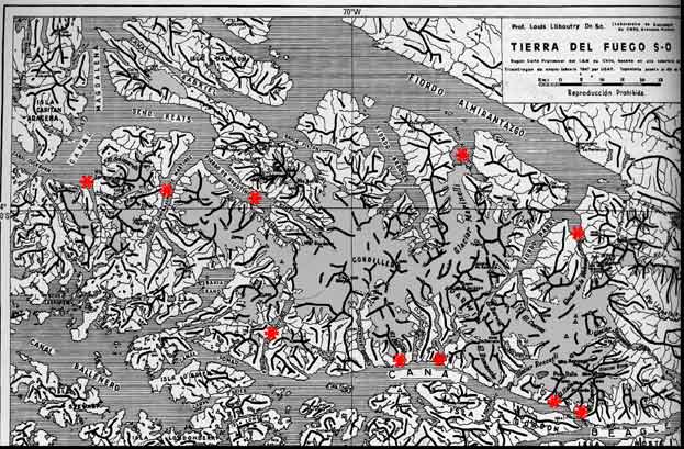
Planned sampling sites marked in red.