(Southern South America) during the LGM and
Termination of the Last Glacial Cycle
Patagonia is an amazing natural region located in the southern cone of South America. Although the Southern Andes are deprived of those tremendous five or six thousand m a.s.l. peaks found to the north, it keeps here two prominent ice fields (Northern and Southern Patagonian ice fields), unique remains of the last glaciation at this latitude. The low temperatures and high amounts of precipitation (>5000 mm) in the western fjords and in high mountains elevations define this tempest region with the four seasons occurring in one day
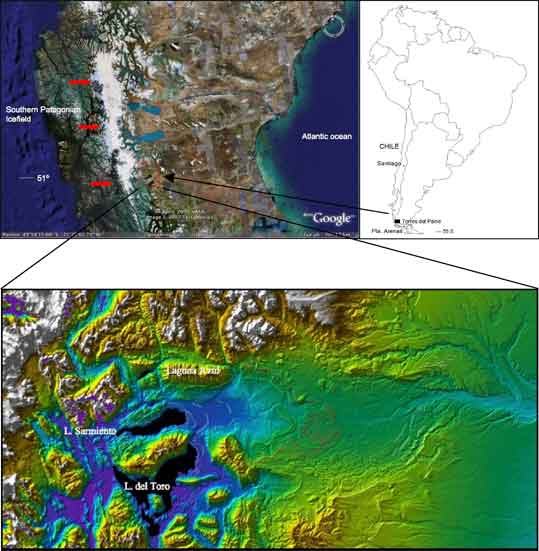
In this figure, Lago Sarmiento and del Toro depict the moraine ridges deposited during the last glaciation (closer to lakes) and during each of the glacial cycles triggered during the Quaternary.
Cordillera Paine is the local name the Andes receive at 51°S, close to the south margin of the Southern Patagonian Ice field. Here the Torres del Paine National Park every year welcomes thousands of visitors and scientists coming from every corner of the planet.

During the Last Glacial Maximum (LGM), prominent outlet glaciers flowed south and eastward from this ice source.
The aim of the project in Torres del Paine is to reconstruct the glacial history during the last glaciation, with special emphasis in the LGM and Transition to the present interglacial (Holocene). I’m approaching the problem through a glacial geomorphologic and geochronologic study.
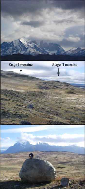
During the first field activity this summer, I mapped 3 moraine complexes, named Stage I, Stage II and Stage III in the areas of Laguna Azul, Sarmiento and del Toro lakes and río Paine. Both Stage I and II moraine complexes comprise between 3–7 moraine ridges and can be followed for several km.
I'm implementing a cosmogenic isotope (10Be) technique for dating the glacial advances and then know the cold pulses during the Patagonian LGM and Termination. I collected rock samples from boulders resting on top of moraines in the areas mentioned above.

