Principal Investigators - Brenda Hall, Chris Hendy (University of Waikato), Glenn Berger (Desert Research Institute)
Other collaborators - Gideon Henderson (Oxford University), Andrew Fountain (Portland State University), Sarah Spaulding (California Academy of Sciences)
Graduate Students
Thomas Whittaker, Sean Birkel, Sarah Millicich (University of Waikato), Jacob Croall (University of Waikato)
Undergraduates - Aaron Schlosser, Amber Hawkins
NSF Teacher - Mary Ann DeMello
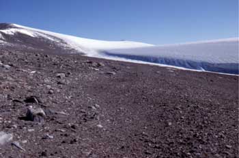
Oblique aerial photograph of high-elevation shoreline in eastern Wright Valley. This shoreline, which trends from the upper (middle) left to the lower (middle) right, is at 566 m elevation and dates to about 15,000 radiocarbon years B.P. Lacustrine sand mounds superimposed on the shoreline yield ages of about 10,700 radiocarbon years B.P., suggesting that lake level reached this elevation at least twice.
Visit our Expedition page.
The cause of abrupt climate change remains unknown. One way in which to isolate the forcing mechanism is to document the geographic and temporal expression of rapid climate variations. For example, if these abrupt fluctuations are globally synchronous, then they may have their origin in the atmosphere. In contrast, one prominent hypothesis is that climate changes are out of phase between the Antarctic and the rest of the world. By this hypothesis, changes in deep-ocean circulation would be responsible for abrupt climate change.
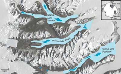
Our project is designed to develop a high-resolution paleoclimate record for the Dry Valleys of Antarctica from water-level changes of closed-basin lakes. These lakes sensitively record hydrologic variations, which are related to regional climate. Our past work has shown that, at times, the lakes were as much as 400 m deeper than they are now. Moreover, they seem to have fluctuated on a millennial timescale. Our present study centers on obtaining a continuous water-level record. To carry out this work, we will spend two field seasons in the Dry Valleys taking sediment cores from the lake bottoms. These cores will be analyzed for sedimentology, mineralogy, chemistry, and biology. These data will allow us to reconstruct former changes in water depth and environment, which can then be related to climatevariations.
Recent Papers
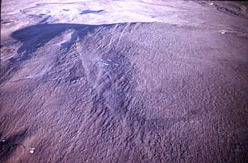
Near-vertical aerial photograph of relict
delta in eastern Wright Valley.
This delta is at about 420 m elevation
and is 8100 radiocarbon years old.
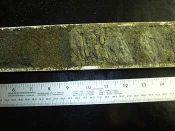
Photograph of a sediment core taken
from Lake Fryxell. This shows the contact
between an organic-rich laminated sand and carbonate.