US ITASE 2000-2001 Discussion and Recommendations for US ITASE 2001-2002
Prepared in the field and submitted by
Paul A. Mayewski (field leader) on behalf and
with the approval and input of the 2000-2001 US ITASE team.
Introduction
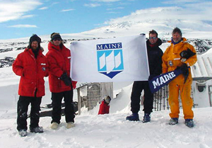 US ITASE
is effectively a polar research vessel. It offers the ground-based opportunities
of traditional style traverse travel coupled with the modern technology
of GPS, crevasse detecting radar, satellite communications and multi-disciplinary
research. By operating as a ground-based transport system US ITASE offers
scientists the opportunity to experience the dynamic environment they
are studying. US ITASE also offers an important interactive venue for
research (currently ten integrated science projects) similar to that afforded
by oceanographic research vessels and large polar field camps, without
the cost of the former or the lack of mobility of the latter. More importantly
the combination of disciplines represented by US ITASE provides a unique,
multi-dimensional (x, y, z and time) view of the ice sheet and its history.
Ultimately, US ITASE will sample the physical and chemical environment
over spatial scales in excess of 3000 km and up to 3000 m depth, over
time periods of several hundred years (sub-annual scale) to hundreds of
thousands of years (millennial scale) covering much of West Antarctica.
US ITASE offers the capability for expansion of its activities into East
Antarctica.
US ITASE
is effectively a polar research vessel. It offers the ground-based opportunities
of traditional style traverse travel coupled with the modern technology
of GPS, crevasse detecting radar, satellite communications and multi-disciplinary
research. By operating as a ground-based transport system US ITASE offers
scientists the opportunity to experience the dynamic environment they
are studying. US ITASE also offers an important interactive venue for
research (currently ten integrated science projects) similar to that afforded
by oceanographic research vessels and large polar field camps, without
the cost of the former or the lack of mobility of the latter. More importantly
the combination of disciplines represented by US ITASE provides a unique,
multi-dimensional (x, y, z and time) view of the ice sheet and its history.
Ultimately, US ITASE will sample the physical and chemical environment
over spatial scales in excess of 3000 km and up to 3000 m depth, over
time periods of several hundred years (sub-annual scale) to hundreds of
thousands of years (millennial scale) covering much of West Antarctica.
US ITASE offers the capability for expansion of its activities into East
Antarctica.
Members of the 2000-2001 US ITASE field program included:
- Steve Arcone (CRREL) – PI surface radar
- Ben Cavallari (U Maine) – field assistant
- Markus Frey (U Arizona) – graduate student air/snow studies
- Cobi Harris (Raytheon) – field safety/food manager
- Gordon Hamilton (U Maine) – PI surface glaciology
- Paul Mayewski (U Maine) – PI glaciochemistry – field leader
- Steve Niles (Raytheon) – camp manager/mechanic
- *David Schneider (U Penn) – graduate student stable isotopes
- *Christopher Shuman (U Maryland)– co-PI stable isotopes
- Zachary Smith (U Maine) – assistant field leader
- *Leigh Stearns (Ohio State U) – graduate student surface glaciology
- Brian Welch (St. Olaf College) – post-doc deep radar
- Mark Wumkes (ICDS) – ice core driller
- *Norbert Yankielun (CRREL) – technical assistant surface radar
- *Bob Zook (Raytheon) – GOES technician
*partial field season
Brief Description of US ITASE 2000-2001 Field Activities
The original plan for the 2000-2001 season was to have a traverse configuration that included one Tucker from the 1999-2000 US ITASE season, a new Challenger 55, one Berco sled for fuel, one Berco sled with a permanent shelter configured for 9 berths and science activities, one Berco sled configured with an active freezer system, one Polar Haven configured as a kitchen and an assortment of smaller sleds (eg., 2 Maudheims, one Polar Associate, 3 Nansens and one Komatik). Two LC-130 fuel drops (3 drops per flight) were scheduled for the season based on estimated fuel consumption.
On the first leg of the traverse, at a distance of 66.6 km from our starting point at Byrd, the Tucker (although hauling a significantly lighter load than that taken during the 1999-2000 season) had a catastrophic breakdown. During the 1999-2000 season the two Tuckers utilized by US ITASE did manage to complete the traverse but with considerable effort. It is clear now that they are not appropriate vehicles for heavy oversnow traverses. On a brighter note the Challenger 55 performed beyond expectation pulling significantly heavier loads than the Tuckers did in 1999-2000 and with slightly better fuel efficiency than expected.
The loss of one of our two heavy traverse vehicles had a significant impact on our style of operation. The Challenger 55 is not large enough to accommodate a driver plus a scientist and crevasse detecting radar so we lost that capability. The Challenger was not able to pull the remaining load although it did significantly out perform the Tucker. After dedicating 5 days to retrograding the Tucker plus any possible additional equipment (this unfortunately had to include the freezer) the traverse proceeded. Under the new style of operation it was necessary to double shuttle loads and to request air support for the pick up of nearly 7000 out of the 8000 lbs of ice cores collected during the trip. In addition, without the freezer, the ice cores had to be buried at each work site. The new style of operation and the better than expected fuel usage of the Challenger 55 negated the need for a second round of LC-130 fuel drops, which we hope balanced our in-field request for air support to retrieve ice cores.
Major Scientific and Logistical Accomplishments of the 2000-2001
Field Season
Between 16 November 2000 when the US ITASE
team arrived at Byrd and 3 January 2001 when the team departed the field
the following major scientific and logistic goals were accomplished:
(1) The Challenger 55 traversed a total of 2400 km.
(2) Continuous radar observations were made over 800 km of the traverse
route.
(3) Seven out of the original nine projected science stations were occupied
for periods of 2-9 days depending upon workload per site. Two sites were
dropped from the original list. One site to save time after the Tucker
failure. We will be able to work at this site in 2001-2002 enroute our
Siple Station traverse. A second site was deleted, close to Mt. Sidley,
because it has too many local climatological effects, the area may have
some crevassing and a snowmobile based radar survey we conducted indicated
highly contorted glacier flow unsuitable for the recovery of ice cores.
(4) Reconnaissance for the proposed inland WAIS deep drilling site that
was cancelled during the 1999-2000 season was accomplished.
(5) A total of 664 m of ice core were recovered.
(6) Seven 2m snowpits were sampled for chemistry, stable isotopes, density
and stratigraphy.
(7) Pemeability and porosity experiments were conducted from two snowpits
and three ice cores were collected for this purpose.
(8) Twenty-one days of atmospheric chemistry observations were conducted
at seven sites.
(9) Observations were made for purposes of ground truthing for satellite
imagery.
(10) Three automatic weather stations were deployed.
(11) Eight high precision GPS ‘coffee can’ experiments were
deployed to measure mass balance.
Details of the 2000-2001 Traverse and Recommendations for Future
Improvements
The information presented below does not guarantee perfect US ITASE seasons
in the future, however, it is intended to be an important step in the
evolution of research style oversnow traverse capability. Several discussion
items follow. They represent the combined thoughts of the members of the
US ITASE 2 (2000-2001) traverse. They are offered as a starting point
for discussions with OPP/NSF and Raytheon.
Heavy Oversnow Vehicles
Steve Niles - Raytheon
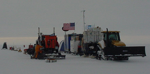 US ITASE
operated with only one heavy oversnow vehicle during the 2000-2001 season
leading to several logistical complications:
(1) crevasse detection equipment was mounted on the Tucker and no longer
available because the Challenger 55 cab is too small to accommodate the
equipment operator and an observer
(2) although very effective, the Challenger 55 could not pull the entire
traverse train, necessitating double shuttling of loads
(3) double shuttling of loads required two people to be away from the
main traverse for two days per science stop (average science stop 3 days)
(4) the traverse functioned without a back up heavy vehicle
The 2000-2001 season certainly put the Challenger 55 through a critical
test and it proved to be a superb traverse vehicle. The Challenger pulled
loads close to 30,000 lbs (versus less than 20,000 lbs for the Tucker)
at speeds between 10-15 km/hr (versus 5-7 km/hr for the Tucker). Furthermore
the Challenger 55 requires significantly less maintenance than a Tucker.
In order to achieve an efficient and safe style of operation for US ITASE
in future years it is extremely important to have a second heavy oversnow
vehicle. A request has already been made to OPP for a second Challenger
55 for use on the 2001-2002 season. We suggest that the second Challenger
55 have several options not available on the first Challenger. These include:
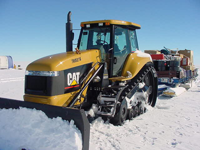 (1)
factory available wider track spacing to decrease vehicle ground pressure
(2) factory made or McMurdo modified cab sufficient to house a driver
plus at least one person for crevasse detection and related equipment
(3) rear winch and cable for aligning traverse sleds
(4) mounting brackets on the blade for crevasse detecting radar
(5) solar charging capability for crevasse detection equipment as developed
for the Tucker
In order to upgrade the current Challenger 55 it would be advisable to:
(1) factory available wider track spacing to decrease vehicle ground pressure
(2) rear winch and cable for aligning traverse sleds
If a second Challenger is not available for the 2001-2002 season, which
we hope will not be the case, we suggest that a suitable replacement be
found. Replacements that could be considered are:
(1) A Hagglund equipped for crevasse detection. Drawbacks include this
vehicles inability to pull heavy loads necessitating double shuttling
by the single Challenger 55 and/or more air support for removal of ice
cores and fuel drums.
(2) A small bulldozer. Drawbacks include a significant reduction in traverse
speed.
We would definitely prefer not to have another Tucker.
Heavy Oversnow Sleds
US ITASE 1999-2000 was fortunate to have two new Berco sleds. One was
used as a fuel/equipment sled and the other as a freezer for housing ice
cores plus roof storage for a variety of equipment. These sleds performed
extremely well. However, an eclectic combination of other sleds followed
the Berco sleds. Somelike the Polar Haven plowed through the snow causing
significant reduction in speed and loss of hauling capacity, others like
the Maudheim did extremely well.
In our 1999-2000 end of season report we strongly urged that two additional
Berco sleds be purchased, one for 2000-2001 and one for the 2001-2002
season. This would provide optimal load carrying capability. In addition,
tracks made by a lead Berco would provide an advantage to following Bercos.
The two new Berco sleds would replace the Polar Haven galley and science
facility used in 1999-2000. The Polar Havens proved sufficient for limited
travel and were required for weight saving in 1999-2000 but they have
several flaws. They are fitted on low-lying runners that plow into snow
on traverse. The significantly rougher conditions expected in future years
would make these sleds even more effective plows, if not anchors, severely
limiting overall load capacity. While comfortable the Polar Havens do
not afford the insulation, sound proofing, or winter-over storage capacity
of more permanent structures discussed below. Furthermore, Polar Havens
require construction and destruction each season.
For 2000-2001 we did not receive a third Berco in time for the field season
so an Ansellen sled was given to us on loan from Scott Base. While we
appreciate the loan of this sled and it is approximately 3 feet longer
than a Berco it is nearly twice the weight (Berco 3500 lbs, Ansellen 6000
lbs) and also higher making loading more complicated. On a traverse weight
is extremely important. In addition Berco sleds have superior runners.
The addition of two new Bercos giving a total of four by 2001-2002 is
strongly suggested. The four Bercos would be used for:
(1) fuel sled
(2) ice core / science equipment (see notes re ice core freezer below
(3) science shelter / berthing (see notes below)
(4) galley / berthing (see notes below)
Science Facility (Blue Room) and Galley
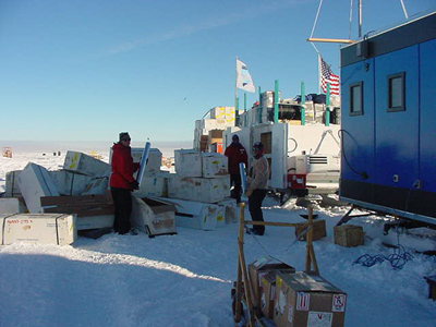 The
US ITASE 2000-2001 team was made up of 12 members. The size of the team
required a galley and the extensive use of electronics and data processing
required a science facility. A science/berthing facility (Blue Room) was
fabricated in McMurdo and mounted on a Berco sled for use during 2000-2001.
The Blue Room contains berthing space for 9, science workspace (for computers,
repairs, communications, temporary wet lab space). It proved to be an
extremely valuable and greatly appreciated addition to US ITASE. In addition
to the above functions the Blue Room saved considerable time versus tent
set-up, acted as a warm space and will provide excellent winter-over storage
space.
The
US ITASE 2000-2001 team was made up of 12 members. The size of the team
required a galley and the extensive use of electronics and data processing
required a science facility. A science/berthing facility (Blue Room) was
fabricated in McMurdo and mounted on a Berco sled for use during 2000-2001.
The Blue Room contains berthing space for 9, science workspace (for computers,
repairs, communications, temporary wet lab space). It proved to be an
extremely valuable and greatly appreciated addition to US ITASE. In addition
to the above functions the Blue Room saved considerable time versus tent
set-up, acted as a warm space and will provide excellent winter-over storage
space.
For the 2001-2002 season we request another permanently Berco mounted
structure to replace the Polar Haven used for the past two seasons as
a Galley. While the Blue Room has been an excellent addition to US ITASE
we request that the new Galley not be constructed of plywood the way the
Blue Room is but rather of lighter weight materials such as stress skin
or fiberglass to reduce weight. Several lightweight prefab structures
are available which are lighter than plywood such as aluminum mill vans
and plastic apples. The new Berco mounted Galley should contain:
(1) Galley space for 12 (a design will be submitted with the forthcoming
SIP)
(2) Berthing for six
(3) Propane boxes mounted on the structure similar to the Blue Room
(4) Solar and wind power generation similar to the Blue Room
(5) Roof space for storage and lightweight equipment tie downs.
The propsed Galley has the following advantages:
(1) Durable, warm shelter and galley capability that will be essential
as US ITASE moves toward South Pole.
(2) Extra berthing (at present two people sleep in the Polar Haven Galley
and one in a tent because the Blue Room has only 9 berths).
(3) Over winter storagecapacity.
Note that with the four Bercos requested as of the 2001-2002 season all
US ITASE winter over storage could be left on sleds or in permanent structures.
This is significantly less labor intensive than placing over-winter storage
on cargo pallets mounted on fuel drums.
Fuel and Power
Several types of fuel were utilized during the season:
(1) Quantity 60, 55gal drums of JP8 for the Challenger 55 to travel 2400km(~.75km/gal).
Note: this fuel consumption average represents an average of heavy loads
and return light load shuttles
(2) Quantity 8, 55 gal drums of Mogas for snowmobiles and four generators.
(3) Quantity 8, 100lb propane cylinders for heating the Blue Room and
galley andfor cooking.
(4) Quantity 22 gallons of white gas were on board as back up for propane
stoves but were not used.
Power generation was as follows:
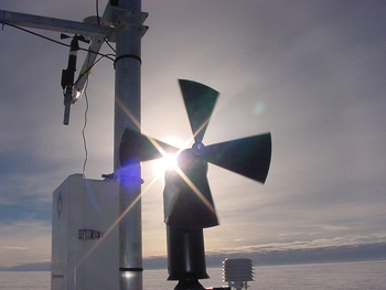 (1)
solar and wind power installed on the roof of the Blue Room for charging
ten 12 volt 100 amp hr batteries plus radio plus computers.
The concept for the system is excellent but it operated below its potential.
Additional testing, more solar panels and tilted panels may correct the
problem.
(2) solar panels on the roof of the Tucker (not available after the Tucker
failed)
(3) one 5000 watt generator for ice core drilling
(4) one 5000 watt generator for melting water
(5) one EW171 (welderator) 4000 watts for charging Blue Room batteries,
welding repairs and operation of air sampling equipment
(6) one 1800 watt generator for deep radar
(7) one 1800 watt generator for melting holes
Air Support including Fuel Drops
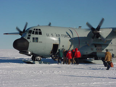
A total of 15 LC-130 flights were dedicated to US ITASE in 2000-2001.
The number of LC-130 flights required for future seasons could be reduced
if:
(1) no breakdowns of major equipment occur such as the Tucker in 1999-2000
and again in 2000-2001
(2) a complete traverse array including sleds and vehicles is available
reducing the necessity for several day set up and breakdown
(3) DC3 (Sky Train) and Twin Otter flights were used to shuttle personnel
and retrograde ice cores from caches. Utilization of these light aircraft
complimented the heavy lift LC-130 capability.
Fuel drops:
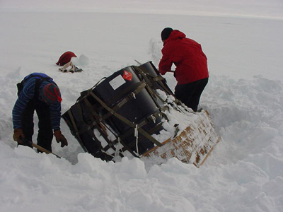 Although
two LC-130 flights were dedicated to US ITASE 2000-2001 for fuel drops
only one was required because of the loss of the Tucker. The 109th ANG
did a superb job of placing three fuel drops at sites planned for scientific
activities. All drops landed exactly on target and the drums were in excellent
condition. Airdrops most definitely provide an excellent way to avoid
carrying large amounts of fuel and burning fuel to carry fuel. Airdrops
will certainly be an important part of our plan for 2001-2002.
For the 2001-2002 field season approximately 120, 55 gal drums of JP8 will be required assuming two Challenger 55’s. Fuel drops will be requested for most of this fuel. However, it is highly unlikely that the traverse will be able to carry the 120 empty drums generated throughout the field season. To counter this situation we will be requesting that 500 gal bladders of JP8 be dropped instead of 55 gal drums. JP8 from these bladders could be pumped to 55 gal drums on our fuel sled. With the addition of one relatively light sled the empty 500 gallon bladders (estimated 10) plus drop materials (chutes, pallets, etc) could be easily hauled by the traverse.
Light Sleds
A variety of light weight sleds were employed including:
(1) three Nansen sleds for camp activities and snowmobile work
(2) one Maudheim for the ice drill and ice core sampling equipment
(3) one Polar Associate to carry snowmobiles
(4) one Maudheim for tools, Herman Nelson, Challenger spares and fluids
(5) one Komatik for deep radar
Note: this sled requires a middle ski and some additional strengthening
to assure that it remains structurally sound throughout future traverses.
Ice Core Freezer
A plywood constructed passive freezer utilized in 1999-2000 was fitted
for the 2000-2001 season with a Thermo-King compressor to provide active
cooling. The addition of the compressor would have assured that ~500m
of ice cores could have been maintained at –20 degrees C throughout
the traverse. With the failure of the Tucker, the freezer had to be retrograded
to Byrd because of its heavy plywood construction and the necessity to
severely lighten the traverse. As a consequence the freezer was never
tested and most of the 9000 lbs of ice cores recovered were retrograded
by DC3 or Twin Otter.
For 2001-2002 it would be preferable to have the Thermo-King compressor
mounted on a significantly lighter freezer unit - one capable of holding
650-700m of core (note 660 m recovered in 2000-2001 plus several boxes
of snowpit samples).. Another option would be to not include the freezer
on the 2001-2002 traverse, 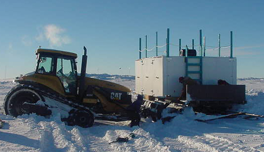 but
instead depend upon retrograding the ice via DC3 or Twin Otter. The freezer
was most essential for 1999-2000 and 2000-2001 because these traverse
legs entered regions where temperatures commonly rise above –15 degrees
C. This could be the case during the 2001-2002 traverse to Siple Station
but will not be a problem during the 2002-2003 traverse to South Pole.
but
instead depend upon retrograding the ice via DC3 or Twin Otter. The freezer
was most essential for 1999-2000 and 2000-2001 because these traverse
legs entered regions where temperatures commonly rise above –15 degrees
C. This could be the case during the 2001-2002 traverse to Siple Station
but will not be a problem during the 2002-2003 traverse to South Pole.
Operating without a freezer in 2000-2001 had advantages (eg., lighter
weight, greater core capacity) and disadvantages (eg., burial of cores
on a daily basis, air support needed for retrograde, added handling and
potential damage, possibility of loss).
Ice Coring Equipment
Mark Wumkes – Spudwood Road, Fairbanks
The primary drill used for the 2000-2001 season was the Ice field Instruments
Eclipse 3’’ ice drill first used by US ITASE in 1999-2000. Overall
performance was excellent with few mechanical breakdowns. It offers some
logistic advantages that make it particularly useful for field traverse
programs;
(1) It is light in weight and can be easily transported without complete
disassembly on a dedicated Maudheim sled.
(2) It takes a 3” diameter core and therefore requires fewer core
boxes to transport and store the core.
(3) It requires only one person to set up and disassemble.
The Eclipse drill recovered approximately 660 meters of core during the
1999-2000 season. The core quality was excellent throughout all drilling
depths making processing easier. It provides a better sample to analyze
for high resolution records. With a few relatively minor modifications
this drill can penetrate deeper depths as needed. It is much easier to
use than the standard 4 “ PICO drill and allows the driller to produce
high quality cores in marginal conditions.
A brief list of suggested modifications is as follows:
(1) Modified cable termination/slip ring assembly. The cable termination
used for the steel drilling cable can be modified to eliminate the intricate
termination process in the field. An external slip ring would not only
be more robust but would also remove it from it’s present location
in the hammer section to a more safe location above the drill.
(2) A telescoping mast could be made which would allow continuous cores
to be taken starting at the surface. This would allow retrieving the upper
2 meters of core as opposed to having to excavate a 1.1 meter drilling
pit is dug to allow for the tilting of the drill. This innovation could
also significantly reduce the necessity for some types of snowpit sampling.
(3) The anti-torque section needs modification to present a more effective
profile to the borehole wall. A double set of 3 springs would offer more
resistance to torque and would allow a slight bit of vertical adjustment
which would enable the drill to penetrate past a point where the drill
has spun in the borehole. Along with this spring modification would be
possibly a heavier motor section that would smooth out the vertical travel
of the drill in the borehole.
(4) A more extensive spare parts inventory. Some essential drill components
had no spares available. Mission critical components should have adequate
spares.
Overall the Eclipse drill worked very well and produced cores of unsurpassed quality. With the incorporation of some essential modifications it is clear that this drill would be the drill of choice for almost any shallow to intermediate coring programs.
Field Mountaineer/Safety Officer/Food Manager
Cobi Harris – Raytheon
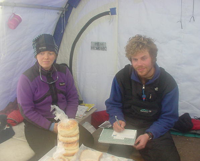 The
Field Mountaineer for ITASE has three distinct responsibilities: field
mountaineer, safety officer and food manager. As Food Manager weekly dry
and frozen food boxes are prepared in McMurdo. On the traverse the weekly
food boxes are organized into labeled bins in the galley. Daily dinners
are prepared for the entire party, breakfast and lunch is the responsibility
of the individuals. In addition, a weekly cleaning schedule is prepared
by the food manager. The Food manager melts all snow for water supply
for cooking, drinking and traveling consumption. Food Manager prepares
kitchen for travel and reorganizes the kitchen for camps.
The Field Mountaineer is the person responsible for any first aid issues
and is the main medic. Upon arrival in McMurdo, the Field Mountaineer
trains all new traverse participants in the “Happy camper” snow
school. A shakedown trip for all participants to Cape Royds or elsewhere
is a good way to get people into the group spirit, as well an opportunity
to get new people used to ski-doos.
While on the traverse the safety officer watches that participants are
communicating and making safe, smart decisions around heavy machinery.
While traveling the safety officer takes turns along with other field
members driving and navigating by GPS. The safety officer is responsible
for setting up briefings related to electrical, chemical and kitchen fires.
When at science camps the safety officer helps as needed. Roles they can
expect to fill are field assistant, drilling assistant, radio communications,
shoveling, heavy lifting, skiway airstrip preparations, snow machine driver,
sledging, etc.
Suggested training courses for the ITASE Field Mountaineer/Safety Officer
might include: an Industrial Safety Course, which includes electrical
and chemical fire safety and heavy machinery safety and continued Crevasse
Training including industrial extraction.
Safety concerns encountered during the 2000-1999 season and how they were
addressed:
(1) Group splitting to double shuttle loads, due to loss of Tucker- Detailed
check out plan for communication with second party. Survival gear required.
(2) Moving heavy equipment in close proximity to people - Radio or hand
signals used.
(3) No crevasse detector due to loss of second vehicle- Relied on RADARSAT
images, reconnoitered questionable area using a ski-doo-Nansen rope system
for protection.
(4) Sleds that plow snow while traveling (Polar Pooper and Polar Haven
Kitchen)- Pooper hauled off center to prevent snow build up.
(5) Kitchen floor a hazard after travel, highly suggest galley/berthing
unit for next year.
(6) Increased fire hazard related to storage of chemicals in the Blue
Room- Fire extinguisher stored next to wet lab. Need Haz-mat box for next
year.
(7) Fire in kitchen or electrical fire in Blue room- Fire extinguishers
stored near high-risk areas.
(8) Heavy lifting- Many people to help with these tasks.
(9) Environmental injuries- Sun screen and hand warmers available.
(10)Dehydration- cold and hot water always available.
(11). Poor decisions due to fatigue- clear communication prior to action.
(12) Crevasse potential - pre-season crevasse rescue training, mid-season
reminder, before reconnoiter.
Polar Pooper
We used a toilet mounted on a sled during US ITASE 1999-2000 and again
in 2000-2001. The system worked very well although the low clearance on
the runners did produce plowing problems resulting in damage to the sled.
A sturdier, higher clearance sled would be preferable.
Communications
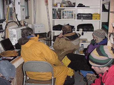 We were
issued 4 HF PRC 1099’s and four VHF radios and borrowed a 100 watt
HF system from Byrd. Daily communications were reasonable despite two
solar disturbances. In addition we were issued a GOES satellite system
largely to be able to maintain our outreach connection with the Boston
Museum of Science. We were fortunate to have a communications technician
with us for the first half of the season (Bob Zook).
The GOES system required several days of major tweeking and with each change of site minor tweeking. Without Bob it is unlikely that we would have been able to set the system up. The GOES IP phone worked infrequently but email was quite dependable. Loan of the GOES system and support is greatly appreciated.
Winter Over Cargo
Considerable effort on the part of the Raytheon put in team and later
the US ITASE traverse team was necessary to dig out cargo lines buried
during the 2000 winter-over of US ITASE equipment at Byrd.
We recommend for the 2001 winter over of equipment that the Challenger be utilized to build snow berms on Byrd Hill (rather than downwind from Byrd Hill) and that cargo lines be developed by staging equipment on Berco sleds and in the Blue Room.
ITASE Team Composition
US ITASE 2000-2001 was comprised of 11-12 people throughout the season.
Numbers varied because of the loss of one individual early in the season
due to medical problems and changeover in personnel. Names of all individuals
involved in the field season appear in the beginning of this report.
For the 2001-2002 season we suggest a team composition very similar to the 2000-2001 team. Three positions require special highlighting, two from Raytheon and one from Ice Core Drilling Services (ICDS). The two Raytheon positions are Camp Manager/Mechanic and Safety Officer/Food Manager. The ICDS position is Ice Core Driller.
We were particularly lucky that Raytheon chose Steve Niles and Cobi Harris to accompany US ITASE this season. Steve’s previous expertise as Byrd Surface Camp Manager, mechanical skills and willingness to participate in every Challenger shuttle leg were essential to the success of this year’s program. Cobi’s mountaineering and guiding skills coupled with her excellent organizational skills assured that this season ran safely and comfortably.
The US ITASE ice core driller contracted by ICDS for this season was Mark Wumkes. He was instrumental in the success of the two major deep ice core drilling activities conducted by the US – GISP2 and Siple Dome. His broad ranging expertise guaranteed the remarkable success of this season’s ice coring activities.
The 2000-2001 US ITASE team owes a great debt to these three individuals and we sincerely hope that ICDS and Raytheon support their involvement in future US ITASE activities.
Proposed Operation Style for US ITASE 2001-2002
Based on the experience gained during the 1999-2000 US ITASE seasons we
propose the following operation style for the 2001-2002 US ITASE traverse.
Although details of the exact route still remain to be developed based
on examination of RADARSAT images and scientific and logistic considerations
we plan to traverse from Byrd to the general region of Siple Station back
to Byrd for a total of approximately 2200km. We plan to make between 6
and 10 several day stops and conduct radar experiments en route.
The traverse team would be comprised of 12 individuals, two Challenger
55’s, four Berco sleds (including fuel sled, ice core/science storage
sled, Blue Room (science/berthing) and a permanent galley/berthing structure)
plus lighter sleds (including Maudheims, Polar Associate, Komatiks, Nansens
and Polar Pooper).
LC-130 fuel drops plus DC3 and Twin Otter ice core retrograde would be
utilized in much the same manner as during the 2000-2001 season.
Major Items for Consideration Prior to the 2001-2002 Field Season
Prior to undertaking the 2001-2002 field season it is important that serious
consideration be given to the following:
(1) US ITASE no longer has a second heavy oversnow vehicle. We recommend
that a second Challenger 55 be purchased.
(2) A Berco mounted permanent galley/berthing sled should be constructed
to replace the existing Polar Haven galley. Lightweight (non-plywood)
construction is critical if the traverse is to be weight efficient.
(3) Fuel drops utilizing 500 gallon bladders should be considered for
this season to avoid having to carry the estimated 120, 55 gal drums of
JP8 required for travel. With the addition of one more light sled (eg.,
Maudheim) empty bladders and air drop equipment (eg., chutes, pallets)
can be relatively easily retrieved.
(4) A lighter weight ice core freezer capable of carrying 650-700m of
ice core with active cooling (utilizing the existing Thermo-King compressor)
or several DC3/Twin Otter ice core retrogrades.
Innovations for the 2001-2002 US ITASE Science Program
Several aspects of US ITASE could be expanded upon if new proposals are
funded. However, if the current and proposed operation style is maintained
it will not be possible to accommodate many new types of programs.
Limitations will always exist in the amount of core that can be transported
and maintained at temperature. If, for example, duplicate cores are required
at sites this will reduce the spatial coverage, which is a mainstay of
the science program.
Requests for additional space in the Blue Room science facility should
be carefully considered. Space is at a minimum and it is not clear that
any fully dedicated space can be guaranteed. The understanding thus far
is that all science space is shared.
It is clear from the science operations undertaken during the 1999-2000
and 2000-2001 field seasons that US ITASE could become even more efficient.
Several recommendations follow:
(1) A more robust deep radar system is essential.
(2) Shock absorption for shallow radar equipment is needed when it is
operated from a snowmobile platform.
(3) Reduction in redundant snowpit sampling (notably density and stable
isotopes) could be accomplished through more cooperation between programs.
(4) Modification of ice coring equipment to allow core collection from
surface rather than 1.1 m depth to reduce dependency on snowpits.
(5) Addition of a lightweight 2” ice coring system to accommodate
special projects such as: fast “snowpits” and extra spatial
coverage.
(6) Utilization of upflow ice cores for more measurements than total beta
activity (eg., chemistry and isotopes) to test small scale spatial gradients.
(7) Expansion of atmospheric sampling program to include major aerosol
species.
(8) Reduced set up time for atmospheric sampling by employing a more permanent
space for this equipment. Set up of the rather fragile atmospheric system
in a Scott tent some 500 m away from camp took usually a full working
day, allowing on average sampling for two 24-hr cycles at each location.
However, operation time at each site can be increased significantly by
mounting the system permanently in a more rigid structure on top of a
Komatic sled. This will be of importance in upcoming seasons where only
2 day stays at each site are planned.
(9) Only the 5 or 4 kW generators provided constant enough power to run
a UPS for atmospheric sampling which is key to protect PMTs and Hg- and
Cd-lamps. In the future we would like to investigate the use solar power
to perform these clean air measurements. A 650 W generator could serve
as a back up and batterie charger.
US ITASE Outreach (See Appendix A for discussion of outreach activities
prior to and following the field season)
During the US ITASE 2000-2001 field season the field team participated
in several outreach activities. These included: a Sunday lecture in McMurdo
(PM), news article for Antarctic Sun (PM, ZS), biweekly live interviews
with the Boston Museum of Science via phone patch through McMurdo (1 November
to mid January (entire team)), daily updates via GOES email link (ZS),
media visit to our field site by National Geographic.
US ITASE 2000-2001 Experiments
by Field Members
US ITASE High Resolution Radar Profiling of Firn Stratigraphy
Steven Arcone - CRREL
The 2000-2001 ITASE field season included high resolution radar profiling
of firn stratigraphy along almost all of the traverse, plus several shorter
profiles near selected core sites. The primary profiling system was a
short-pulse 400-MHz radar, but a 100-MHz radar was also used. The purposes
of the stratigraphic studies are to (1) establish the cause of radar horizons
in firn, including correlation with core chemistry profiles; (2) establish
the distance over which radar horizons can be tracked and therefore established
as regional benchmarks for historic studies of accumulation rates; and
(3) find if there is topographic control on accumulation rates. Our 2000
field accomplishments include the following:
(1) High resolution 400-MHz profiles to between 65 and 125 m depth were
acquired along the entire 800 km main traverse. About 40 km of transect
profile are missing because of mismanagement in the Raytheon medical office,
and loss of personnel due to medical problems. The depths profiled far
exceed the 56 m obtained last year, provide no loss in layer resolution,
and were achieved after some experimentation with recording parameters.
Thus we now have the ability to profile the entire firn regime. It appears
that in any profile, but especially in the higher accumulation zone in
the eastern part of our traverse, a few reflection horizons are expressed
as isolated wavelets. These may be followed for hundreds of km, and will
be used as isochronal surfaces for accumulation rate studies. Almost all
reflections can be reasonably tracked entirely because the apparent “folding”
(a topographic effect on accumulation rates) is not as intense as seen
last year. All strata appear surface conformable, but firn thickness between
any two horizons can vary by several meters depending on location along
the profile, and dip up to 20 m.
(2) Other observations are as follows. Layer horizons separate into isolated
reflections at the anticlinal parts of folds (possibly on hilltops where
accumulation is less), as opposed to interfering multi-reflections in
synclines where accumulation may be much greater. Our extended traverse
from site F to G (site not cored and near Mt Sidley) revealed the tightest
folds, some of which appear disconformable with each other, and confirmed
Paul Mayewski’s decision to avoid coring near Mt. Sidley site. These
folds appear to be tectonic in origin as there appears to be no surface
topography which could cause them.
(3) Experimental 100-MHz profiles were acquired at site E and the proposed
WAIS core site for comparison with those at 400 MHz to look for relative
amplitude changes in the same horizons. My preliminary assessment is that
the lower frequency shows more sensitivity to some horizons and through
large depth changes so that their reflectivity must be related to electrical
properties other than those caused by density changes. However, the 400
MHz profiles provide far superior resolution, as expected.
(4) Only a few profiles were acquired in other directions about the core
sites because it is now clear that our main traverse profiles truly represent
the disposition of the strata to within several km of any site, and because
of limited resources caused by the loss of the Tucker. Nevertheless, we
acquired 25-50 km extensions at the proposed WAIS core site and sites
C, E and G. The extensions at sites C and G helped to fill in the profile
gaps necessitated by our lost Tucker and need to avoid the apeces of our
traverse.
5. Although we were unable to run crevasse detection radar because of
the lost Tucker and the need to move along quickly, there is no evidence
in any of our profiles that we had encountered crevasses. This information
is important for future traverse studies.
My immediate priority is to process all profiles with spherical beam spreading
loss compensation. Distance normalization (to account for changes in profiling
speed) and topographic corrections will be made when the GPS data becomes
available from Gordon Hamilton and Leigh Stearns. I will then prepare
some of my most important results for the AGU meeting in Boston. We will
establish core stratigraphic correlations when the core results are obtained.
For next year we will give serious consideration to using a deep sounding
radar we have developed and tested on smaller glaciers and which need
not be operated from a small shelter in hopes of achieving the deep sounding
information missed during this and last year’s traverse.
US ITASE Glaciochemistry
Paul A. Mayewski, Zachary Smith,
Benjamin Cavallari– University of Maine
During the 2000-2001 US ITASE we sampled snowpits and retrieved (with
the support of Mark Wumkes) and prepared ice cores for the following projects:
University of Maine (major anions, cations and MS), University of Arizona
(reversible ionic species), CRREL (permeability and firn structure), CRREL
(ice core stratigraphy), University of Washington and University of Colorado
(stable isotopes), University of Maryland and NASA (snowpit stratigraphy).
Ice cores (total 660 m, 9000lbs) and snowpits (2m per site) were recovered
and packaged at seven sites for the common use of the research teams noted
above. The ice cores ranged from 105m in depth at the proposed WAIS core
site to on average 60m at other sites plus several 15-30m ice cores dedicated
to other projects.
Accomplishments of the US ITASE ice core and snowpit glaciochemistry sampling
program include:
(1) Snowpit and ice core sample coverage over the regions bounded by 77-82
degrees South and 105-130 degrees West.
(2) Integration with surface glaciology activities conducted by Gordon
Hamilton and Leigh Stearns to allow deconvolution of local topographic
effects from the accumulation rate record.
(3) Integration with shallow radar activities conducted by Steve Arcone
to assess the source of radar reflectors and to enhance interpretation
of ice core records through 3D views of core sites.
Our major research goals are to establish:
(1) Calibrated proxies for atmospheric circulation features such as the
Amundsen Sea Low, ENSO, the Antarctic Circumpolar Wave and katabatic flow.
(2) Calibrated records that document variability in, for example, sea
ice extent, volcanism, marine biogenic activity and trends in major ion
chemistry deposited over Antarctica.
(3) Detailed understanding of the spatial and temporal (sub-annual to
multi-decadal) complexities in climate within and related to Antarctica.
US ITASE Deep Ice Radar
B. Welch, St. Olaf College
After environmental difficulties during the first season of ITASE, we
expected our summer efforts to result in greatly improved radar profiles.
Although we have overcome the temperature problems with our equipment,
software and the extremely rough conditions of the traverse created a
new suite of difficulties.
Our 12-bit radar system should be a great improvement over the old system
used by Bob Jacobel at Siple Dome in 1996-1997. However, the ruggedness
of the ITASE traverse requires new designs for the antennas, peripheral
devices, and software. I found that of all the ITASE programs, the deep
radar is most vulnerable to the rough conditions created by the traverse
vehicles, most notably the ruts created by the Challenger and the ability
of the vehicle to pull the radar system without warning.
The new insulated radar shelter mounted on an extra-wide Komatik sled
works very well for the most part, keeping the equipment at temperatures
above freezing with only limited need for heat blankets. However, the
deep tracks of the Challenger caused the sled to plow in the snow so we
revised the harness to have the sled track off to the side of the traverse
train. The flatter snow outside the tracks gives the sled and the computer
a gentler ride, but puts severe strains on the radar’s forward receiver
antenna. Additional strain is placed on the front transmitter antenna
as its sled tracks in and out of the Challenger ruts. The deep ruts resulted
in four broken antennas and much lost data. When the antennas break the
radar signal is lost and much time was spent tracking the signal loss
to the problem (the antennas are sheathed in nylon webbing that hides
the breaks). Once the antenna problem was found, several attempts were
made to create a more robust towing system for further travel, but there
was little success with the limited resources available.
With the problems of cold and vibration virtually eliminated, the new
radar system worked well enough to find some software bugs that occasionally
erased or corrupted data files. These problems have mostly been isolated
and the fixes will be implemented before the next field season. Despite
the difficulties, I was able to collect some 20 km of verifiable data
and approximately 100 km of questionable data with the new radar system.
Further processing in the lab will show the quality of the data sets.
Due to the problems with the new system, I moved to the old system that
Bob Jacobel used during last year’s traverse to collect data at the
Swithinbank and Mid-Camp sites. For reasons that are still unclear, this
old system was also unable to collect data due to a great deal of ringing
in the antennas. Software and technical questions were easily resolved
thanks to email access through the GOES-3 connection. A variety of tests
showed that the generator, traverse sleds, and other local power sources
(generators, inverters, etc.) caused small amounts of electrical noise,
but were not the primary sources of the interference. Broken antennas
were replaced or repaired to eliminate them as problems. At this stage
we believe that the problems with the old system are either due to damaged
equipment (either in shipping or due to the traverse), the radar shelter
itself, or operator error.
This year’s traverse showed that the travel conditions are far rougher
than we had expected. As a result, our equipment needs to be strengthened
before the next field season. The antennas and their connections must
be strengthened, all electrical connections need strain relief and locking
connectors, and the computer software must save the data to permanent
storage to avoid data loss during power failures. The antennas present
the greatest difficulty since they are each 20 meters long. We expect
to look into either suspending the antennas above the snow or to encase
the antennas in a stronger sheath, such as PVC pipe or a fire hose. To
test the robustness of the system, we will either field test it during
summer glacier field work, or tow it through farm fields around campus
in order to simulate the terrain of the ITASE traverses.
US ITASE Surface Glaciology
Gordon Hamilton – University of Maine; Leigh Stearns – Ohio
State University
 Major
accomplishments include:
(1) Continuous, high-precision GPS profiles along the full traverse route.
Additional local profiles of elevation were collected at the Inland WAIS
site. These data will be used to provide geographic and topographic control
for the CRREL ground-penetrating radar. One of the objectives of the combined
GPR/GPS work is to understand the pattern of spatial variations in snow
accumulation rate and the causes of these variations. Another objective
of the GPS profiling is to understand the causes of brightness variations
observed in the RADARSAT mosaic of West Antarctica.
(2) Installation of eight “coffee-can” sites to measure the
long-term rate of change of ice sheet thickness. Three sites are located
along a transect approximately orthogonal to the Inland WAIS ice divide,
with a spacing between sites of ~25 km. Results from these sites will
be used to test for migration of the ice divide with time. A fourth site
is located approximately 50 km across the divide into the Amundsen Sea
sector of the ice sheet.
(3) Collection of seven shallow firn cores for accumulation rate. The
cores will be analyzed for gross beta radioactivity. Derived accumulation
rates will be used in the calculation of ice thickness change rates and
in understanding local variability in snowfall around the ~200 year core
sites. At Site C, spatial variability in accumulation rate was studied
using GPR.
(4) Mapping surface topography and measuring horizontal velocities at
the ~200 year ice core sites. The purpose of this work is understand the
ice dynamic effects on ice core accumulation rate histories.
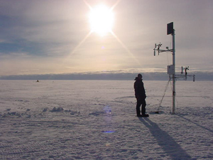
(5) Installation of three automatic weather stations/RASCALs (Remote Autonomous
System for the Control of ALtimetry) at coffee-can sites close to the
Inland WAIS ice divide. The instruments are designed to study the timing
and causes of transient fluctuations in snow surface elevations. This
work is related to understanding and interpreting the results from ICESat,
a NASA spaceborne laser altimeter scheduled to be launched in December
2001. The instruments will also provide meteorological information about
the Inland WAIS region in advance of the potential deep ice core program.
Each instrument is equipped with: wind direction sensors at two vertical
levels, acoustic depth gauges (‘snow elevation sensors’) at
two vertical levels, air temperature at two vertical levels, barometric
pressure sensor, thermocouple probes at four levels in the shallow firn,
linear transducers at four levels in the shallow firn (to continuously
record firn compaction). Instruments are powered by a battery bank buried
beneath the surface and recharged using solar panels mounted on the mast.
Data is stored on a data logger; there is no telemetry.
Other than the vehicular problems experienced by the whole traverse team,
there was only one problem that inconvenienced the surface glaciology
program: a box of science equipment was lost between the time it was entered
into the cargo stream in McMurdo and put-in at Byrd Surface Camp. The
box contained a number of important items, including a survey level rod,
and anchors, washers and wire cable used in the coffee-can work. There
was a slight delay in having replacement parts fabricated properly, which
led to one lost day of work. Unless the box is located, there will be
a monetary loss of ~$1,000.
US ITASE Stable Isotope sampling and snowpit stratigraphy
David Schneider, University of Pennsylvania (graduate student); Christopher
Shuman, University of Maryland (co-PI)
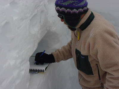 During
the 2000-2001 US ITASE field traverse, six snow pits were sampled for
stable isotopes and density to a depth of 2 meters and one pit at the
proposed inland WAIS site was sampled to a depth of 3 meters. All pits
were sampled at 2-cm resolution, which will allow the study of sub-annual
to sub-seasonal climate variability with broad spatial coverage. Species
that will be measured at the University of Washington include d18O, dD,
and deuterium excess. The University of Washington will also be responsible
for measuring stable isotopes in the 7 ~60-meter cores obtained by the
US ITASE traverse. Visual stratigraphy was done in the field in each of
the snow pits at 2-cm resolution. These observations will correspond with
density measurements and stable isotope measurements in each snow pit.
On an experimental basis, two snow pits were sampled at 10 cm resolution
for analysis of nitrogen and oxygen isotopes in nitrate, and surface snow
samples were obtained at four sites. If results prove successful, this
work may be further incorporated into subsequent field seasons.
Stable isotope sampling adds relatively few logistical complications to
the US ITASE traverse. The only major concern this season has been the
storage and transport of the nearly 800 samples. If the 2001-2002 US ITASE
traverse has a freezer aboard, some space should be designated to stable
isotope samples, as the samples must be kept as cold as possible. Additional
considerations for next year include: Increased high-resolution spatial
coverage at each drill site, perhaps achieved by several ~3 m deep, 2-inch
diameter firn cores; greater collaboration with the University of Arizona
and other institutions on density and snow temperature measurements; expansion
of sampling for nitrogen and oxygen isotopes in nitrate; establishment
of atmospheric stable isotope monitoring achieved with a vapor-trapping
system.
Major Research goals include:
-Calibration and correlation of the stable isotope signal with data from
automatic weather stations, satellites (including SSM/I (scanning sensor
microwave/imager) and SMMR (special sensor microwave radiometer), and
meteorological reanalysis.
-Characterizing the distribution of stable isotopes across West Antarctica.
-Understanding source conditions/locations of moisture transported to
the Antarctic ice sheet.
-Interpreting the stable isotope record with respect to climate variability
on a variety of spatial and temporal scales.
-Identifying major influences on Antarctic climate, e.g. ENSO
US ITASE Air/Snow Exchange Studies
Markus Frey – University of Arizona
 In global
change research it is of major interest to understand how the composition
of the earth’s atmosphere has changed over time due to natural and
human causes. An important parameter is the atmosphere’s oxidation
capacity, which ultimately controls the removal of greenhouse gases and
pollutants from the gas phase. Among the major atmospheric oxidizing agents
are the OH-radical, ozone (O3) and H2O2. Only the latter is preserved
in ice cores. In addition, organic molecules such as higher peroxides
and formaldehyde act as photochemical reservoirs for the OH-radical. All
these compounds are, however, reversibly deposited to the ice sheet such
that between snow fall and burial and eventually pore close-off the chemical
signature of these species changes due to physical and chemical processes.
Once these non-linear exchange processes are understood ice core records
of peroxides and formaldehyde provide a valuable archive of how atmospheric
chemistry has changed due to anthropogenic emissions or the ozone hole.
Major goals for the US ITASE traverse are to establish a picture of spatial
variability in West Antarctica of peroxide and formaldehyde concentrations
in the boundary layer and upper snowpack layers. Also the question, if
the snowpack is a potential source of these species to the lower troposphere
is adressed. In addition, information about parameters controlling the
chemical exchange such as accumulation rate, air and snow temperature
and wind parameters need to be monitored or derived by other means (e.g.
net accumulation through the strong seasonal signal of H2O2 preserved
in ice cores). This involves atmospheric measurements and snow pit sampling
(incl. density and temperature).
Major accomplishments of this season’s traverse include:
(1) A total of 21 days of continuous atmospheric measurements of formaldehyde
(HCHO), hydrogen peroxide (H2O2) and higher organic peroxides (e.g. methylhydroxyl
peroxide MHP) have been conducted. This involved monitoring diurnal cycles
and detecting the levels of these trace gases in firn air and at various
heights above the snow pack. HCHO is measured with a commercial instrument
made available by the Alfred-Wegener Institut, Bremerhaven (Germany) and
peroxides with a custom made instrument assembled in our lab in Tucson,
Arizona. The analytical method is based in both cases on an aqueous phase
reaction with subsequent fluorescence detection. Separation of higher
peroxides is achieved by use of High Pressure Liquid Chromatography (HPLC).
All reagents and liquid standards to calibrate the instruments on a daily
basis are prepared in a temporary wet lab in the Blue Room. Mean HCHO
concentrations are also measured by means of DNPH cartridges which absorb
organic molecules from a constant air stream pulled through a portable
water purification system available for the generation of clean water.
(2) 1-2 snowpits of one meter depth at each one of 7 locations sampled
for HCHO and peroxides (special containers to reduce loss or contamination)
at a resolution of up to 1 cm. Density measurements were undertaken as
well with a custom made sampling tool allowing for intercomparison with
other methods. Snow temperature was monitored at 16 depth intervalls.
Meteorological variables were recorded with a DAVIS weather monitor, including
barometric pressure, temperature and wind direction and speed
(3) One set of snow samples (420 total), kept in SCHOTT bottles, will
be analyzed in the Crary Lab right after the pull out from Byrd Surface
Camp. A second set will be transferred to Arizona for future analysis
of ionic species, such as formate or acetate.
Already before further data processing it can be stated that among the
results are the first reported quantitative measurements of MHP in the
boundary layer over Antarctica.
APPENDIX A - US ITASE Outreach Program Prior to and Following
Field Season
Zachary Smith
At the conclusion of the 2000-2001 field season the outreach efforts will
be continued and include: presentations to schools and organizations around
the country, enhancement of the US ITASE web sites (Boston Museum of Science,
www2.umaine.edu/USITASE), the distribution of US ITASE posters and standards-based
educational materials, and scheduled teacher workshops.
 Educational
Outreach Program Methodologies
The goal of the educational outreach program at the Institute for Quaternary
and Climate Studies (IQCS) at the University of Maine is to educate students
and the public about climate change and the US ITASE program. To accomplish
this goal, the outreach program focuses on disseminating information through
the use of web sites, posters, school visits, IQCS facilities tours, written
standards-based educational materials, and teacher workshops. These standards-based
educational materials translate scientific information from the US ITASE
program for use in K-12 classrooms and by the general public. Much of
the outreach efforts are accomplished through liaisons set up between
the IQCS and the Boston Museum of Science, the Wright Center for Science
Education at Tufts University, the Rythmics Sonifications Laboratory,
the United States Cold Regions Research and Engineering Laboratory, and
numerous other institutes and agencies.
The educational materials developed correspond to both state and National
Science Standards. The use of standards-based materials stems from the
growing need by educators around the country for science curriculum guidelines.
Student laboratory exercises, that follow the state and national standards,
have been written based on actual polar research experiments done on US
ITASE. These laboratory exercises include topics such as measurement of
permeability and porosity of snow, radar, ice core interpretation, mapping,
and glacier flow modeling.
Video
A video on the US ITASE program is being produced. Most of the footage
in the video is taken on location in Antarctica during the 1999-2003 field
seasons. When complete, this video will be an excellent source of background
information about ice core drilling projects and the US ITASE program.
This video is being produced in cooperation with the Boston Museum of
Science and the IQCS.
Workshops and Presentations
Two teacher workshops for the US ITASE program were held in the last twelve
months and two more are organized for the next twelve months. This year’s
workshops will be held at the IQCS facilities at the University of Maine.
These workshops provide teachers background information and experience
with the scientific project, and are supplied a full assortment of educational
materials to take back to their classrooms. Workshops are advertised through
the New Hampshire Science Teacher Association newsletter, the Maine Science
Teacher Association list serve, and the Boston Museum of Science web site,
and other resources. Members from the US ITASE team are on-hand to present
to teachers.
On July 25th, 2000 a three-day teacher workshop, “Studying Climate
Change in the Classroom”, was held in Wolfeboro New Hampshire. This
workshop was co-sponsored by the Climate Change Research Center at the
University of New Hampshire and the Wright Center for Innovative Science
Education at Tufts University. It was filled at twenty-nine teacher participants
from five countries and twelve US states. The three-day event involved
the presentation of IQCS-developed materials, a look at current earth
science teacher/student programs, participation in interactive laboratory
exercises, and presentations by guest researchers and peer teachers. Sessions
were presented by Dr. Paul Mayewski (co-director of the IQCS), Dr. Barry
Keim (NH State Climatologist), Dr. Stephanie Shipp (co-PI of Teacher Experience
in Antarctica), Dr. Jack Ridge (Tufts University geology professor), Dr.
L. David Meeker (University of New Hampshire), and area high school teachers.
Full-time educators that work with students in grades 6th and up were
eligible to apply. This workshop was free to participants.
Workshops in the next 12 moths include a one-day teacher workshop to be
held in the Spring of 2001 and a 3-day teacher workshop, co-sponsored
by the Wright Center at Tufts University, to be held at the IQCS facilities
at the University of Maine in July 2001.
Other presentations on US ITASE will also take place at the North East
regional Geological Society of America conference in Burlington Vermont
and at the Maine Science Teacher Conference both in the spring of 2001.
Proposals were also written to present at the National Science Teacher
Association (NSTA) regional conferences in San Diego and St. Louis, and
the 2001 NSTA national conference.
Web Sites
The IQCS maintains two web pages, one provides information about the
department and ITASE/US ITASE (http://www2.umaine.edu/USITASE) and another,
in collaboration with the Boston Museum of Science, focuses on the US
ITASE project. The department web
page features many of its current projects (including US ITASE) data
sets from the research projects, abstracts from professional papers,
and links to other pertinent web pages. This web page is useful for
audiences that have a general understanding of climate change and can
utilize data sets. The text and pictures offer a basic introduction
to climate science and the data sets offer a rarely offered opportunity
for students to graph and interpret real data. Students can then develop
their own ideas about climate change from the data sets.
The US ITASE web page, in cooperation
with the Boston Museum of Science, offers an array of links that provide
background information about Antarctica and an interactive section that
directly links the public with the scientists in Antarctica. The interactive
section has three parts: a question/answer section where people can ask
questions directly of the scientists in Antarctica; a section with daily
updates from the field team; and an archive of the live phone calls made
from the field team in Antarctica to the Boston Museum of Science. Daily
communiquÈs from the team in Antarctica focus on both current weather
information and the daily work of the team. Since an important aspect
of the expedition is to collect ice cores, a log of the total amount of
ice core drilled was also recorded. Through this section people worldwide
can stay abreast of developments with the team as they travel across Antarctica
collecting ice and snow samples. This segment is also highlighted by digital
images sent through the Internet by the team. The Boston Museum of Science
maintains a current display for the US ITASE expedition and provides the
facilities for the public to listen to the live phone conversations from
Antarctica. As data is analyzed, appropriate findings of the last US ITASE
expeditions will also be posted. This web site includes activities for
students to “dress the scientists” and to investigate relationships
of paleoclimate records as collected on the GISP2 Climate Card (data from
the Greenland Ice Sheet Project 2-GISP2).
Classroom Posters
For US ITASE a high school/middle school-appropriate poster has been developed.
These posters contain vivid photos and diagrams along with written descriptions
that explain the project. The posters, approximately 24” x 30”,
are designed to be hung in middle school and high school classrooms and
serve as a graphic reference for the project and a stimuli for generating
student questions. Each poster also contains the project’s web site
and the list of participating institutions involved. This is considered
an important section of the poster and helps students obtain further information
as well as providing an understanding of the extent of collaboration in
current scientific projects. The poster is given out free at school presentations
and teacher workshops. Money to produce the poster was provided through
the IQCS departmental budget. Future plans include production of a larger
number of posters for distribution to more classrooms.
School Visits
During the spring of 2000, presentations at over two dozen school were
given. Classroom presentations were made to students in grades kindergarten
through 12th grade. Before each presentation, teachers were supplied with
grade-appropriate outlines for the presentation with the flexibility to
adapt to each classroom’s specific requirements. Presentations focused
on the environment of Antarctica for younger grades to the interpretation
of data and the sensitivity of Antarctic climate for older students. Important
scientific concepts, such as age/depth relationship that corresponds to
the Law of Superposition, were introduced at age-appropriate levels. Each
teacher was also supplied with all available IQCS educational materials
and recommendations were made for follow-up activities with the students
after the presentations. Follow-up activities often took the form of classes
writing their own “books” on Antarctica, in a form similar to
that of Aurora Australis, the book published by Ernest Shackelton and
his men on the 1907-1909 British Antarctic Expedition. For Aurora Australis,
Shackelton and his men wrote short stories and poetry and produced lithograph
illustrations about their time in Antarctica. The books produced by students
typically remain in the classroom for reference by the students. Many
more presentations have already been requested for 2001.
Institute for Quaternary and Climate Studies Facilities Tours
The facilities of the IQCS are always open by appointment for tours. The
department houses ice cores from all of the IQCS ice coring projects including
Asia, Antarctica, and the Arctic. Tour participants are taken through
the ice core storage freezer, the ice core processing rooms, and the chemical
analysis laboratories. The complete one-hour tour provides participants
with an introduction of the department’s research and a view of the
process of collecting ice cores in the field to the final stage of data
analysis. Students tours have also been given in cooperation with other
scientists at the University of Maine.
Written Materials
The written materials that have been developed are in three forms, background
information booklets, classroom laboratory exercises, and the GISP2 Climate
Card. Another product, titled Glacier, Climate, and the Landscape, is
an educator’s guide to glacial geology and glacial morphology land
features.
Over a dozen classroom laboratory exercises have also been produced that
are in different states of classroom testing. The classroom exercises
are written largely for grades 5 through 12 and have a focus on polar
science. Many of the exercises are original and closely follow experiments
done by scientists on polar expeditions. The exercises are written for
teachers that would like their students to perform laboratory experiments
and demonstrations that allow them to understand important scientific
concepts typical in polar studies. The concepts include; albedo, porosity
and permeability, radar, depth to age relationship, and the structure
and development of glacial morphological features. The laboratory exercises
are standards-based, hands-on, multi-stepped, and typically require students
to quantify and graph their results. These exercises are available to
teachers of any grade level. Each laboratory exercise takes one to two
class periods to perform. Background information, valuable resources,
and a reference to specific scientists and their polar research projects
are supplied with each exercise. Also being developed for each of these
exercises is a photo essay or video that records real scientists performing
the laboratory exercises. This photo record will assist teachers and students
as they perform the laboratory exercise in their classrooms, and it will
help them gain insight into how real scientists perform actual experiments.
Program Assessment
Assessment of the outreach program at the IQCS is conducted by monitoring
the continued number of responses that we have received from teachers
for information, live presentations, and written materials. A number of
teachers have been asked to participate in a study of the effectiveness
of the US ITASE outreach program. These classes range from grades K-12th
and are located throughout the United States and Europe. Each teacher
is asked to follow the US ITASE expedition on the web site during the
field season, utilize IQCS educational materials, and have their students
interact with the scientists during the expedition. These teachers have
also been asked to complete written evaluations of the effectiveness of
the outreach program. This will create a more comprehensive and detailed
analysis of the outreach program and enable the outreach coordinator to
modify the program as determined suitable by this assessment. The written
program evaluations and follow-ups with these teachers will be conducted
in the spring of 2001.
Conclusion
With public interest directed at global climate change and diminishing
air quality, there is a definite need for standards-based, real-time,
interactive, student outreach programs. Through the use of the US ITASE
program, the interactive web site, and the companion classroom-appropriate
materials, the Institute for Quaternary and Climate Studies outreach program
has been able to make a positive impact on students and their teachers.
Plans are being finalized to host multi-day science workshops for school
districts in Maine, New Jersey, and New Hampshire. Continued curricular
materials and web site development, teacher/student workshops, and international
partnerships are also planned.
