
 New Zealand
 Prepared by: Nancy Bertler
email:nancy.bertler@vuw.ac.nz
Drilling Locations and Collected Data Sets
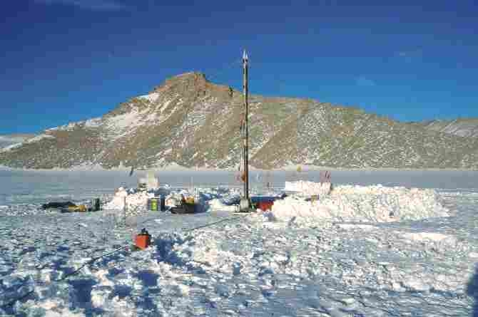
Victoria Lower Glacier Dome (VIC I)
Location: S 77º19’48”, E 162º31’55”
Altitude: 626m asl
Distance from the coast: 25km
Samples and data obtained:
1999/2000 |
Recovery
of 36m firn core, snow stratigraphy, dust collection, borehole
temperature, mass balance (coffee can) measurement, meteorological
observations (AWS) |
2000/2001 |
Sampling
of 4m snow profile (1cm resolution), snow stratigraphy, density
and temperature profile, mass balance (coffee can) measurements,
ground penetrating radar mapping of Victoria Lower Glacier internal
structures and bedrock topography (35, 200, and 400 MHz frequencies),
meteorological observations (AWS), diatom and dust traps |
2001/2002 |
Recovery
of 180m ice core, mass balance (coffee can) measurement (Borehole
is cased and capped for future measurements in the next few years) |
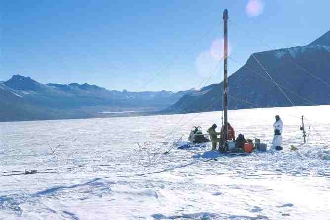
Victoria
Lower Glacier Tongue (VIC II)
Location: S 77º20’49”, E 162º29’32”,
Altitude: 577m asl
Distance from the coast: 30km
Samples and data obtained:
| 2000/2001 | Sampling of 1m snow profile (1cm resolution), snow stratigraphy, density and temperature profile, mass balance (coffee can) measurements, shallow 2m ice core, GPS survey of surface topography, ground penetrating radar mapping of interior glacial structures and bedrock topography (35, 200 and 400 MHz frequencies), collection of dust samples from near-by sand dunes |
| 2001/2002 | Recovery of 10m ice core, mass balance (coffee can) measurement |